Home » BLOG » sailing

Category: sailing

Anything between point A and point B

The Mona Passage

IMG_7985

After the strange happenings in Bahia Escocesa, we motored away from the shores of the Dominican Republic past Cabo Cabron and took turns resting throughout the night. The sun came up and the rare weather window we had been carefully monitoring held steady with 2-3′ waves and 5-10 knots of wind in the Mona, just as predicted. We trolled the fishing lines and barbequed lunch on the aft deck enjoying our most pleasant passage yet.

Van Sant’s guide recommended staying North of the Mona Passage, far away from the treacherous Hourglass Shoals and afternoon storm cells gaining strength from Puerto Rico’s coast and that’s just what we did. Of course the wind is always on the nose, no matter which direction we are going, so we motorsailed across The Mona Passage as quickly as we could before our golden window collapsed.

IMG_8077IMG_8008DSC_0294DSC_0292DSC_0283

Peter hooked a good-sized Sierra Mackerel, but unfortunately that’s all the fish gods gave us between the DR and Puerto Rico. We still had plenty of fish in our freezer so this one was all for the dogs. We supplement their dry food whenever we can and they are always happy to get a hearty portion of raw fish in their bowls.

IMG_8114IMG_8107IMG_8150IMG_8151IMG_8109IMG_8153IMG_8156IMG_8245

We approached the shores of Puerto Rico before the sun came up the morning of May 6th and had made way better time than anticipated. Still taking advantage of the weak night lees of the West Coast of Puerto Rico, we continued South by East before arriving at La Parguera around 8am. Just outside the little town, we anchored near the mangroves and fell fast asleep. After 3 months at sea, we were finally back in US Territory!!

IMG_8074IMG_8102DSC_0310

Thanks for reading!! Stay tuned for pictures and stories of how we spent almost the entire month of May in Puerto Rico and the Spanish Virgins, then all of June in the BVI!! We are currently on our way south to Grenada for the remainder of Hurricane Season… Leave us a comment, we’d love to hear from you!!!

Salty Myths and Secret Lore: The Haunting of Bahia Escocesa

SALTY MYTHS AND SECRET LORE… stories we’ve heard, and tales galore…

DSC_0310

The morning of May 4th I gazed in awe from inside the cockpit as the sun rose over the horizon with golden rays of light splashing across the surface of the water. Still out of the north, the Atlantic swell gently pushed against our hull as we motorsailed 55 nm east across Bahia Escocesa towards Playa El Valle (or what Van Sant calls “Puerto Escondido”). The deep fjord-like hillsides seemed to engulf our tiny boat with each turn of the propeller. The water was deep so we made our way in as close to the beach as we could get. It was overwhelmingly peaceful and secluded inside this quiet anchorage.

DSC_0161DSC_0159DSC_0174DSC_0154DSC_0244DSC_0249IMG_8036

To our port, in the middle of the rich green hillside, small flames blazed around huge brown holes that were recently burned away. Natural or planned, we won’t know for sure. It’s hard to believe such a remote village would organize any planned burning in an area like this, however, after a little research I found a website that infers that there are lots for sale here with future development of roads and bridges. The site looks old and we all know that many development plans often fall through. It would be a shame to see this beautiful and secluded area disappear.

DSC_0253DSC_0254DSC_0256

Suddenly, Peter noticed a small herd of cattle roaming free along the base of the valley. They strolled along what looked to be their own private beach. Our stay in Escondido was a little rolly but very relaxing and peaceful. If we weren’t on schedule to cross the Mona Passage, we would have enjoyed spending some time in this wonderfully secluded anchorage.

We expected local officials to come visit our boat, but they never did. Maybe they don’t work on Sundays…

DSC_0265DSC_0277DSC_0227DSC_0190DSC_0181DSC_0199DSC_0215DSC_0236

8pm flashed on the iPhone as the alarm blared through the cabin letting us know we were finally ready to leave our last anchorage of the Dominican Republic. We were officially checked out of Luperon and still located west of Samana so our despacho still held true. Puerto Rico was the next stop and there would be no more officials chasing us down in the dark of night to inspect our papers.

Every morning that week we had tuned in to Chris Parker on the SSB for validation that the weather window for May 4th, 5th and 6th was still holding open. The forecast called for 2-3′ seas and 5-10 knot winds across the dreaded Mona Passage. A forecast like that for the Mona does not come often and we knew this was our best chance. The timing was perfect. Although we carried only 3 meager months of sailing experience, we were about to depart across a notoriously treacherous passage, known to be the most dangerous stretch in all of the Caribbean, with conditions that most sailors in this area wait weeks for.

The familiar darkness surrounded us. Peter called out that the anchor was free and I slowly steered toward our course using only the compass and radar. I had gotten a good look at our surroundings in the daylight and felt confident I could get us moving in the right direction with the absence of the light of the moon. Our GPS is useless until there is enough forward momentum to figure out which direction the boat is moving.

After only a few hundred feet I noticed a small blip on the radar overlay directly in the path of our recommended route. I shouted out to Peter on the stern where he was washing his hands after guiding in our rusty anchor chain, “I think there’s a boat in front of us!” I turned 30-degrees to port as Peter joined me in the cockpit to take a look at what I saw. The blip appeared on the screen again, directly off our bow. I turned back to starboard 30-degrees. Still there.

“Maybe it’s a fishing boat,” Peter whispered. We’ve seen local fishermen row around setting nets in the late evening hours close to shore. Their old wooden boats bear no navigation lights and often no motors.

We eased off the engine and coasted for a minute or two. Repeated taps on the chartplotter screen indicated the blip was ALWAYS .32 or .33 nm in front of us, dead center off the bow. We sped back up to cruising speed only to find the blip sped up too.

Those that know Peter know he has impeccable vision. His eagle eyes can spot birds working over the ocean miles away. His fish eyes can spot and identify anything that moves within 100′ while swimming underwater. His night-vision is unreal. If anyone could see what was in front of us, it was Peter. He quickly grabbed the spotlight and made his way up to the bow. He hoped to see a glow, splash, reflection or something… instead he saw nothing but blackness.

With each rotation of the radar, the blip kept changing shapes, like a cloud in the sky on a sunny day. It definitely wasn’t waves. Waves have a distinct way of scattering around the boat on the screen and never reappear in the exact same place again. It wasn’t a water spout. The skies were clear and littered with stars. It wasn’t the shore. The radar signature showed features of the coastline to our starboard that were consistent with the graphics on the chartplotter. We wracked our brains trying to think of what else would cause a signature like that.

Before leaving the dock back in Florida we installed a High Definition Garmin Radar system with an 18″ dome mounted on our mizzen mast. It can pick up the smallest of objects including birds, navigational markers, mooring balls, waves and squalls. It shows other boats so accurately we can make out the stern and bow. The gain can be adjusted to filter out sensitivity as well.

What we saw on the radar that night was beyond eerie, bordering supernatural.

Following Van Sant’s guide, we “motored tight against the cliffs in the flat calm” exiting the anchorage and heading East. Is it a coincidence that it’s at this exact part of the guide that he tells how this bay is also named “the Scots Woman” and a woman supposedly haunts the bay? He goes on to say, “on different occasions I’ve talked with sober and mature merchant seamen who told me they have heard the crying of a woman while crossing the bay at night.” He then reports that he logged a peculiar melancholy during his first trip across the bay, years before learning of the haunting.

There is no other way to explain the feeling that Peter and I had that night, other than we felt as if the tiny blip on our radar screen was leading us out of Bahia Escocesa. It stayed with us for the entire length of the Eastern headland until we rounded Cabo Cabron, then vanishing from our screen as quickly as it had appeared.

IMG_8058IMG_8059IMG_8060IMG_8061

For ages, salty sailors have told stories of strange happenings out at sea. Though intrigued by the mysteries of those that have gone before us, the stories we tell here are our own. What do you think might have caused the eerie radar signature we saw? Please leave a comment your thoughts about our experience!!

The Thorny Path to Windward

Year after year, cruisers like ourselves sail south from the East Coast of the U.S. and make our way toward the Caribbean. We brave the swells, storms, currents and Trade Winds planning our every move around weather windows. The North Coast of the Dominican Republic is by far the roughest leg of the journey and many often sail right past it jumping off from Turks and Caicos and arriving in Puerto Rico.

We decided to take what old salts like to call the “Thorny Path to Windward” fighting the cape effects and coastal acceleration sailing dead into the wind as we make our way East. We followed Van Sant’s guide, or what he likes to call the “Thornless Path to Windward,” all the way across the North Coast of the DR and we are forever grateful for his wealth of knowledge. Most helpful was his suggested itinerary for departure and arrival times at various points along the coast. With a few minor tweaks on the departure times, Van Sant’s itinerary saved us from getting beat up on the near 300nm journey from Luperón to Puerto Rico.

Capture

Ready to say good bye to Luperón, Peter and I went into town one last time to get our despacho before the Navy building closed at 5pm. The DR is very strict about being cleared in and out of each port of call, inspecting yachts in transit for any illegal stowaways. We made sure to ask the officials to document that our next stop would be the next major port of call, Samana. It’s okay to stop along the way for weather and resting, but any officials we might have encountered would need to see that we were properly cleared out of Luperón and our next destination is recorded as still within the country. If we had declared that our next stop would be Puerto Rico, but we had stopped again along the DR coast, we would have been checked out of the country already and in a heap of trouble with the local authorities. If we don’t stop at Samana, it’s no big deal. Puerto Rico doesn’t care to see the despacho at all.

The Navy officials were willing to process our paperwork at 4:30pm since we told them we were leaving within the hour. If we were not going to leave right away, they wanted us to wait until the next day and come back to get our despacho then. Conveniently, the officer was not able to get ahold of anyone that could come out to inspect our boat since everyone had gone home already. He processed our despacho, shook our hands and sent us on our merry way.

Peter and I had no intention of leaving at 6:00 in the evening, knowing the Trade Winds were surely still piping outside the harbor with less than friendly seas pummeling across the entrance. Didn’t they know who Bruce Van Sant was? He lives in Luperón for crying out loud!! Hadn’t they dealt with thousands of other cruisers following Mr. Van Sant’s recommendation to leave at 4am? Apparently not.

Around 2:00 am I untied the lines and made my way out to the bow with a spot light. Peter carefully motored through the mooring field navigating around the mud shoals as I shined the light on approaching boats and vacant mooring balls. The twinkling of anchor lights in the harbor pierced the thick darkness of the night blending in with the stars up above. The flat calm waters quickly disappeared as we followed our tracks back out through the channel. The waves grew bigger and bigger.

Just then, in the darkness behind us, I saw a light. It was a small boat with several men in it and they were headed right for us. Their outboard motor was at full speed and they were going over the waves almost vertically. Not a single one of them spoke English. They were screaming at us and telling us to turn around. It was 2am in the darkest of nights with huge waves coming straight toward us and we happened to be in the narrowest part of the channel. With a cliff to our starboard and a dangerous shoal to our port, they insisted that we turn around that instant, not even a little bit further.

I quickly scrambled down below and grabbed our despacho and held it with two hands out the side of our cockpit trying to show the men that we had clearance to leave that day. They were very suspicious and tried to board our boat. I waved the despacho at them again, reaching my arms as far as they could go without falling out of the boat. I was trying to block their entrance to board us while showing them we had valid documentation. Thank God I had it in a clear plastic sleeve (like the kind we used to use for book reports in elementary school). The waves were slamming up against the boat spraying saltwater everywhere. They took it from my hands to examine it closer. The men were on radios trying to reach someone. Peter was busy trying to navigate the boat so he couldn’t pay attention to what they were saying. The dogs were barking, the wind was howling, the waves were crashing against the cliffs and we were relying solely on our chartplotter and radar. It was quite possibly the scariest moment we’ve had so far.

After Peter got the boat turned around he attempted to idle in the tiny area the current had pushed us towards. Anyone that has a Whitby knows these boats DO NOT turn or back up, especially in tight places, and with 3-4′ waves pummeling the beam. What seemed like 20 minutes later, they let go of the side of our boat and in a confusion of broken Spanish, they finally told us it was okay. “Adios?” I screamed. “Si, Si, Adios!” they chuckled back.

Were they absolutely insane??? That was the worst possible moment to approach and tell us to turn around. Peter’s excellent Captain skills got us out of that mess safely, but it sure was scary.

We arrived in Sosua around 7am on May 2nd after taking advantage of the calmer night lee winds. After 8am is when the winds really pick up and we took Van Sant’s advice and made sure we were securely anchored before then. We dropped the hook inside a reef with waves breaking just 200′ from the boat. That may seem like a good distance but when 8′ waves are breaking on either side of you, it’s kind of unnerving. There weren’t any options for staying out further due to a significant dropoff past the reef. Van Sant had also said to not travel or anchor here in a North swell but in order to make an amazingly calm 3-day window for crossing The Mona Passage, we had to traverse the DR coast on a schedule.

Music blared from the beach all day and vacationers zipped around on a huge inflatable banana towed by a little fishing boat. Paddleboarders were surfing the shore breaks and kids were swimming in the shallows. We tried to get a little rest during the day in preparation for the next departure later that night.

DSC_0014 DSC_0015 DSC_0016 DSC_0017 DSC_0030 DSC_0032 DSC_0034 DSC_0036 DSC_0039 DSC_0043 DSC_0045 DSC_0056 DSC_0060 DSC_0066 DSC_0073

We rounded Cabo Macoris in the middle of the night and made short tacks inside the lee of Cabo Frances Viejo stopping off at Rio San Juan the morning of May 3rd. This part of our journey was pretty uneventful, motorsailing all night and sleeping all day.

The swell wasn’t as bad in the old fishing village of Rio San Juan but we still left our mizzen sail up while were anchored behind several old fishing boats. Having the mizzen sail up keeps us pointed into the wind and significantly reduces the amount of rocking back and forth from the relentless North swell funneling in to the anchorages on the North Coast.

DSC_0077 DSC_0088 DSC_0094 DSC_0105 DSC_0116 DSC_0126

We left Rio San Juan around 9pm that night knowing we would be fighting the Equatorial Current around Cabo Frances Viejo and wanted to clear the cape well before 8am the next morning. We kept with our current schedule of planning the next arrival for 8 or 9 am before the winds picked up.

The shores of Bahia Escocesa led us to what Van Sant calls Puerto Escondido, tucked inside a gorgeous hillside of mountains and cliffs. This would be our last stop before crossing The Mona Passage the following day.

Passagemaking: Turks and Caicos to the DR

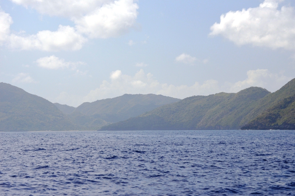
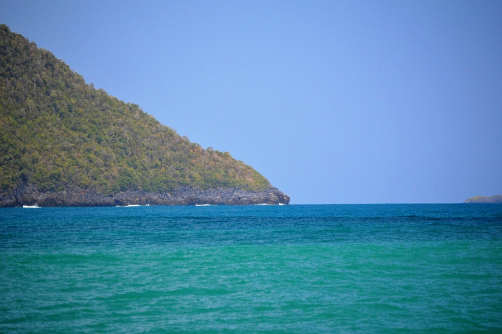
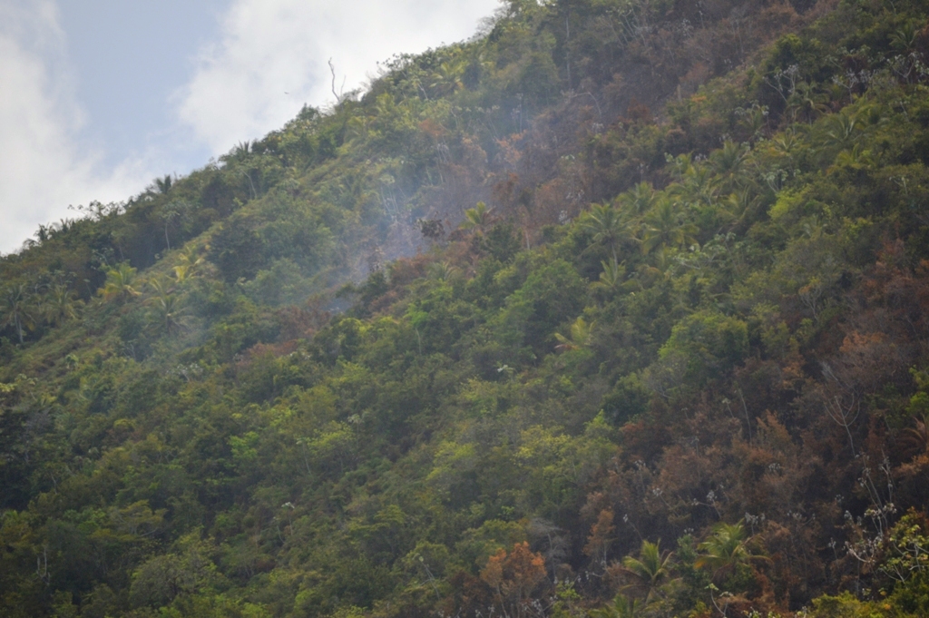
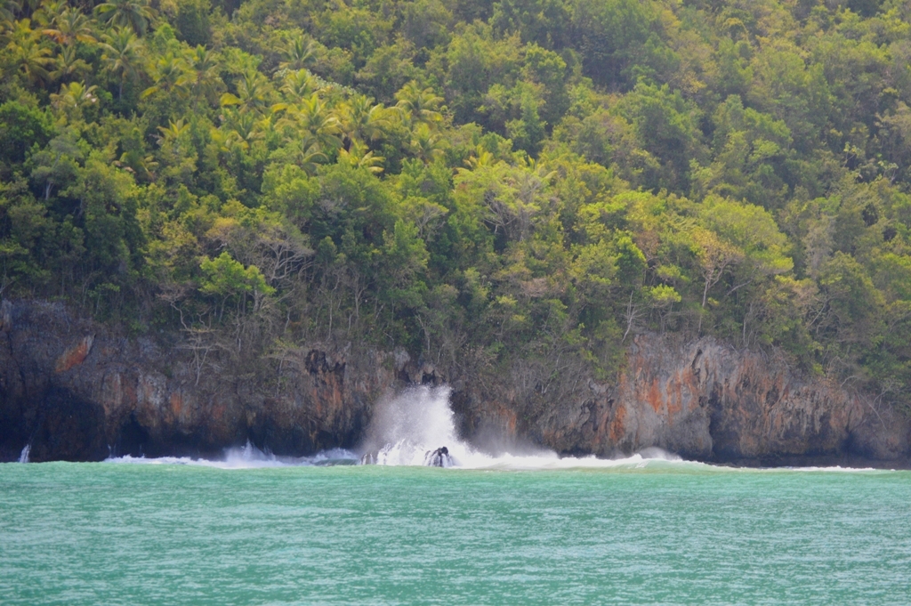
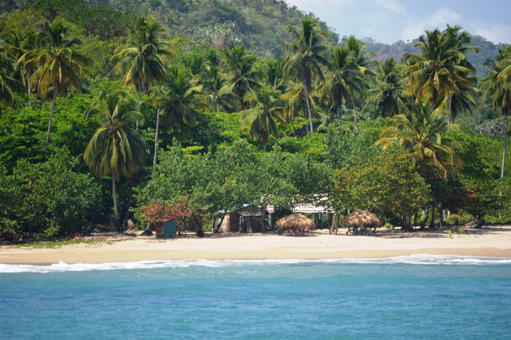
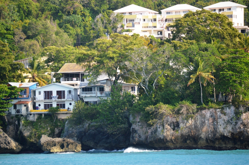
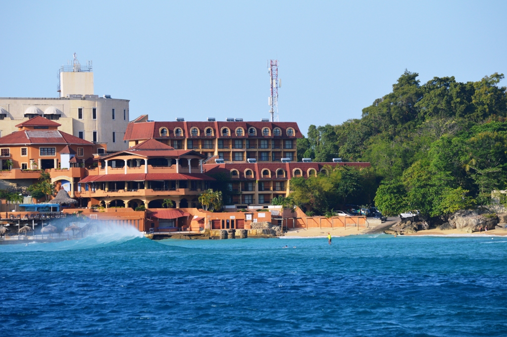
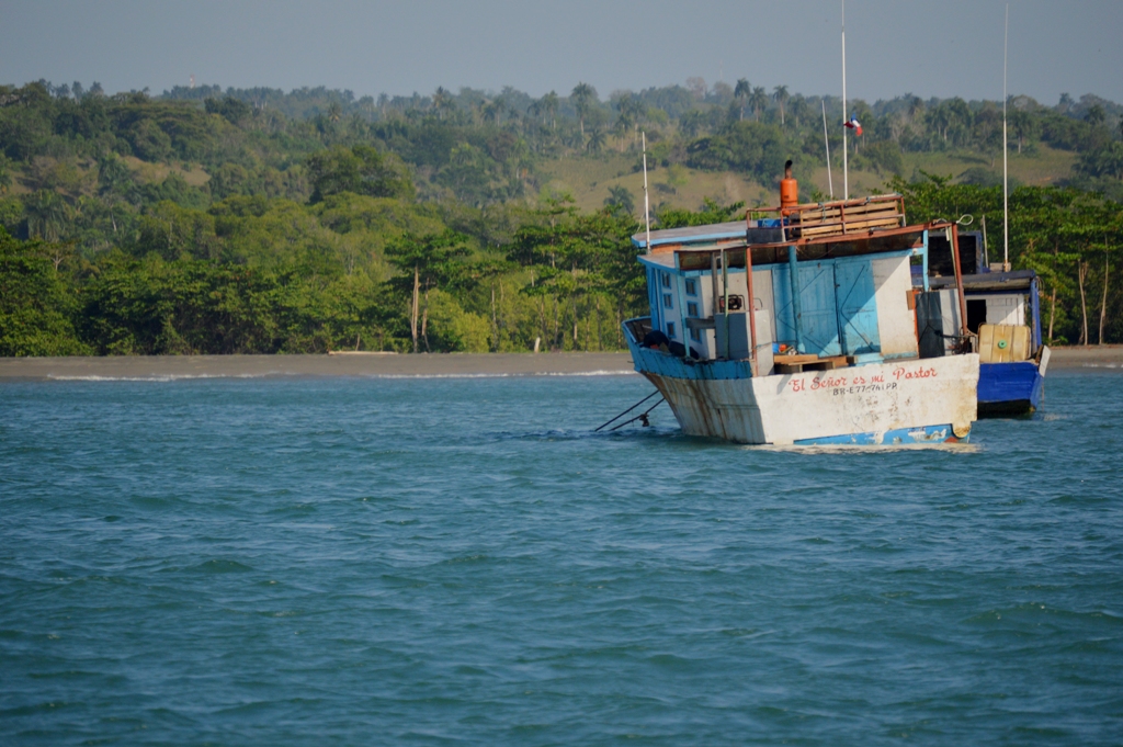
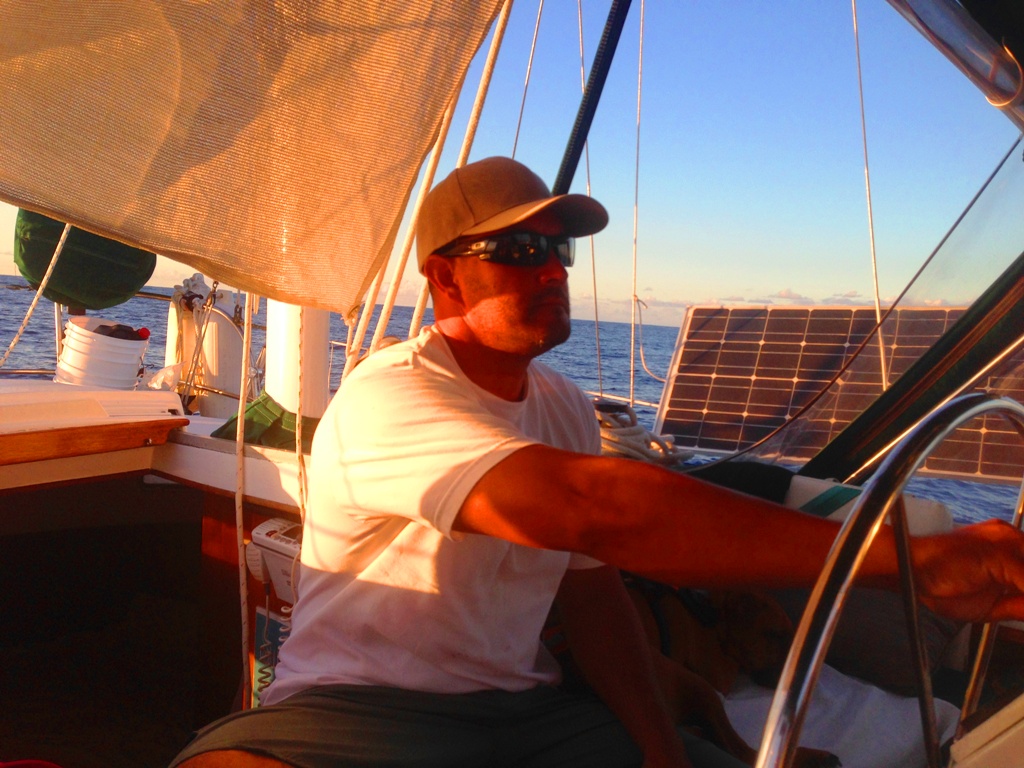
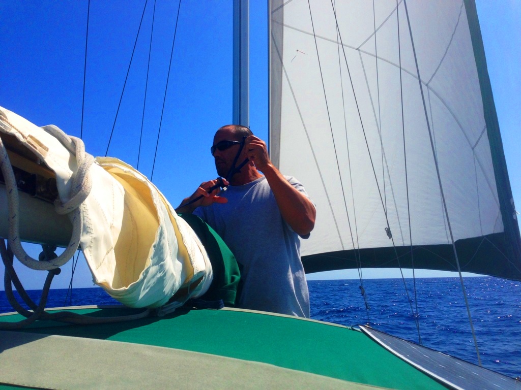
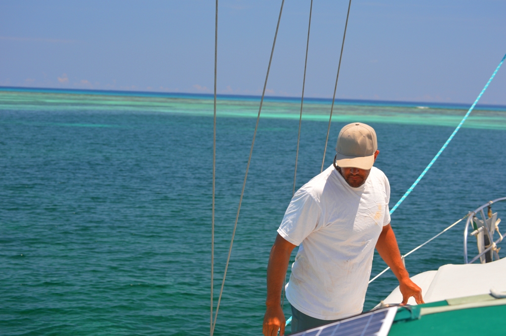
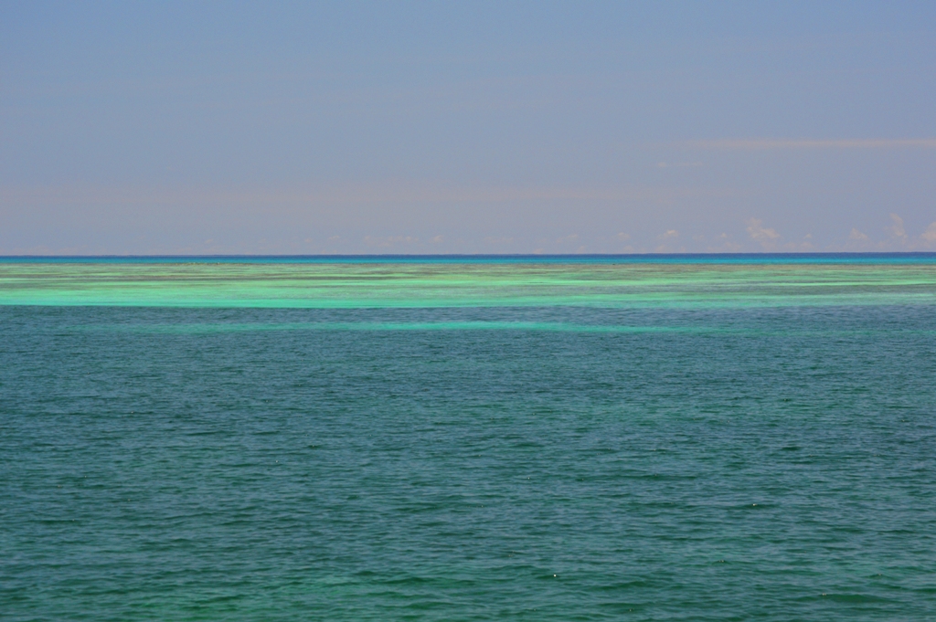
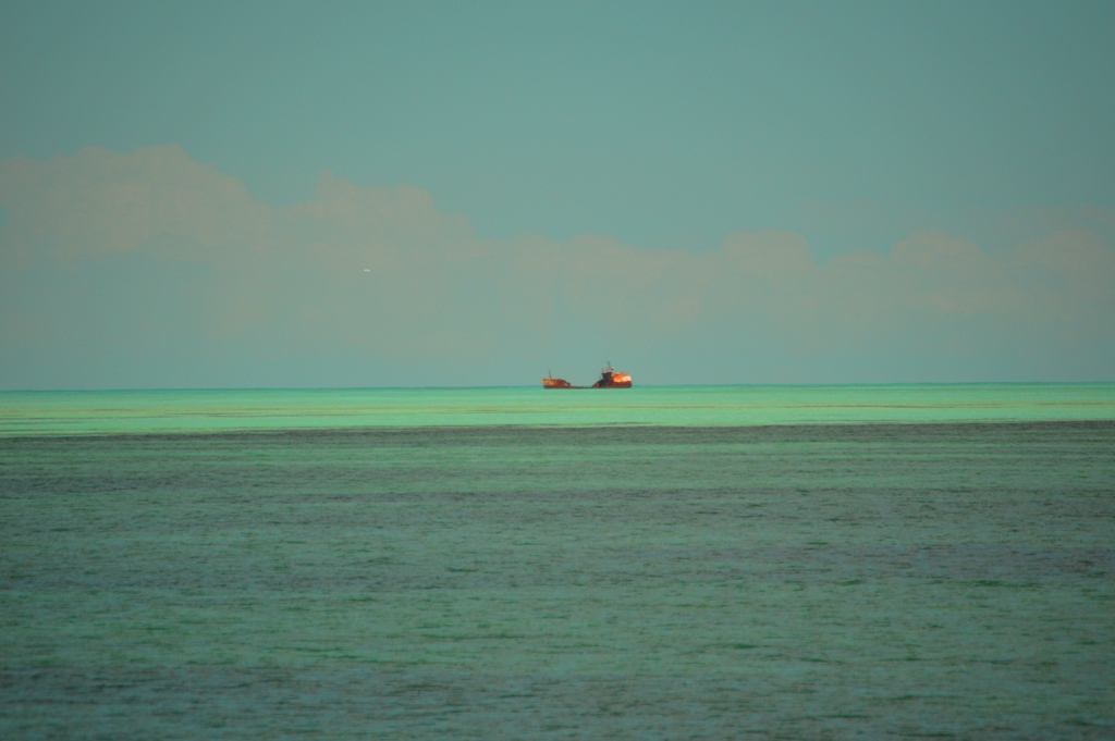
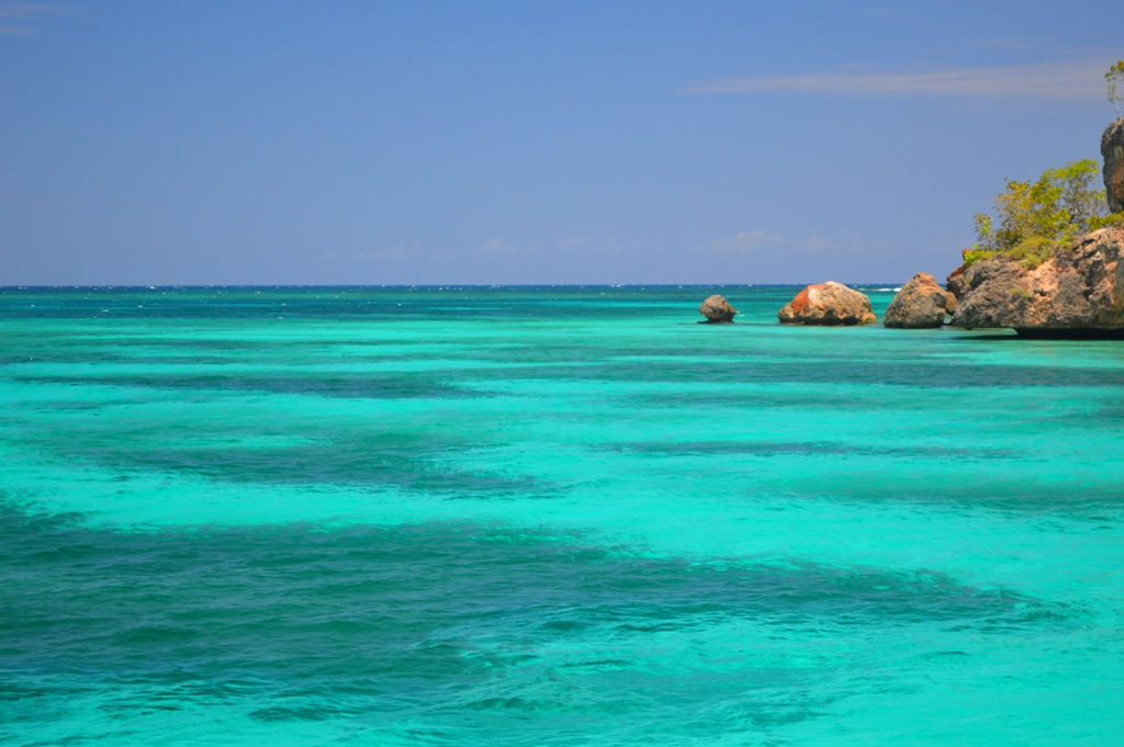
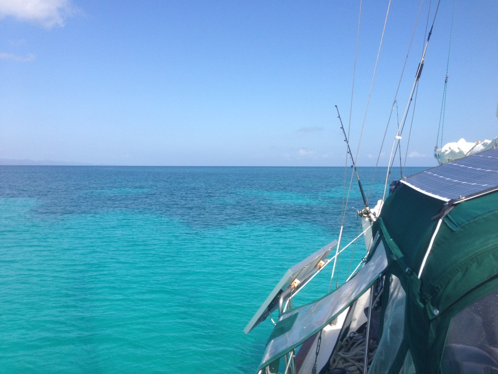
After a rough passage from the Bahamas, the auto-pilot did a beautiful job bringing us through the last leg from the Crooked Islands to the shores of Turks and Caicos. We arrived at the Southwest Reef just off West Caicos in the early morning hours of April 23rd. The water was crystal clear and everything seemed so still. We could see the bottom perfectly in 60′ depths.

IMG_7435IMG_7436

With no other boats in sight, we guided the Mary Christine in towards a recommended anchorage on our charts. We decided to fly the Q(quarantine) flag instead of checking in to customs and immigration since we were only stopping for a few hours to rest our weary eyes before continuing on to the Dominican Republic.

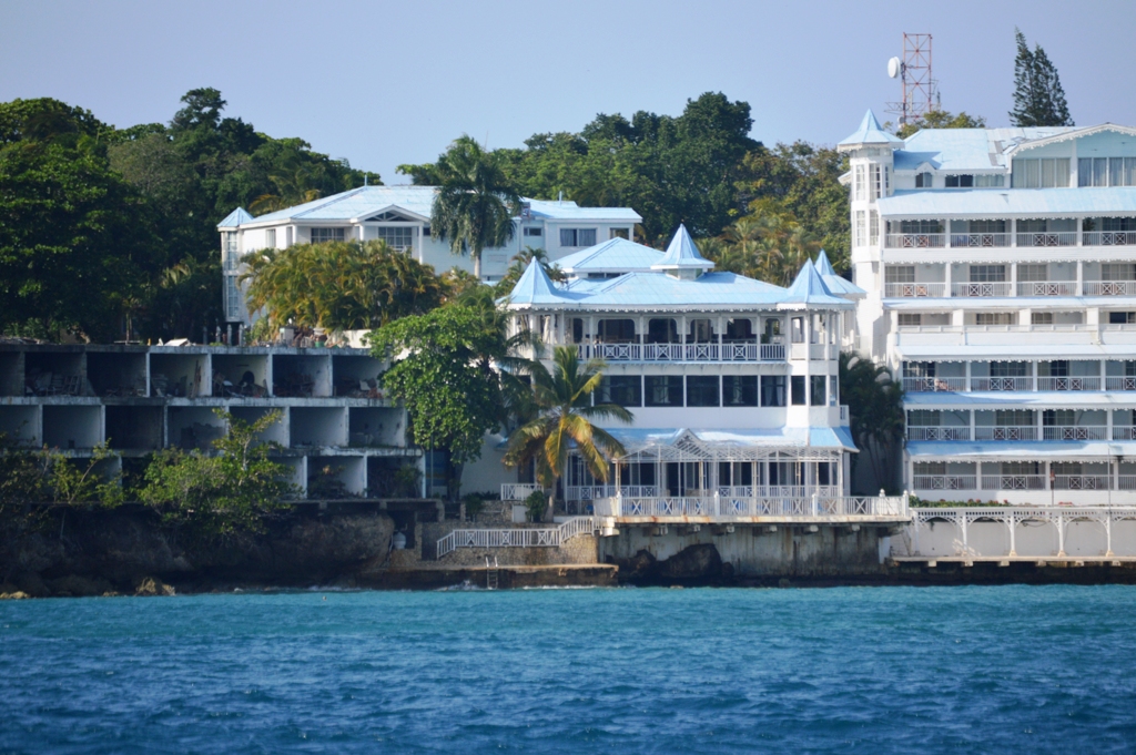
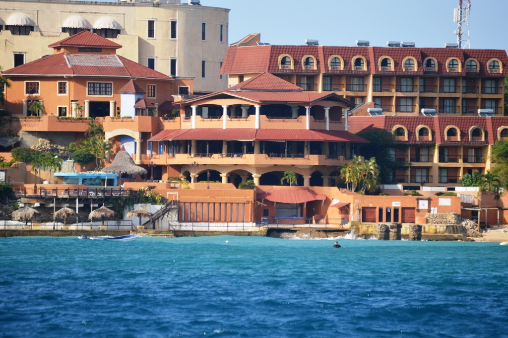
While it might have been nice to explore Turks and Caicos, their procedures for clearing in and out were less than desirable. From what we understand, an ‘up to 7 day’ visit (including stopping for fuel) will cost you $50 for inward clearance and another $50 for outward clearance. Weekends are $65 each way. If staying more than 7 days, a cruising permit must be obtained for $300 (good for 90 days). Spearguns and Hawaiian slings are also illegal and must be brought in to Customs when you clear.

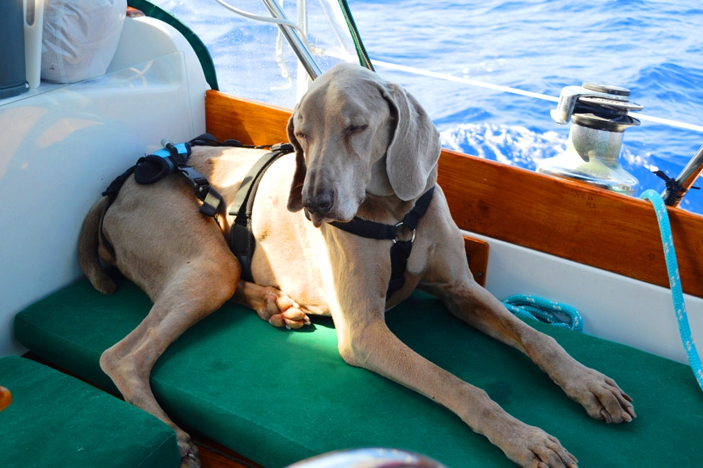
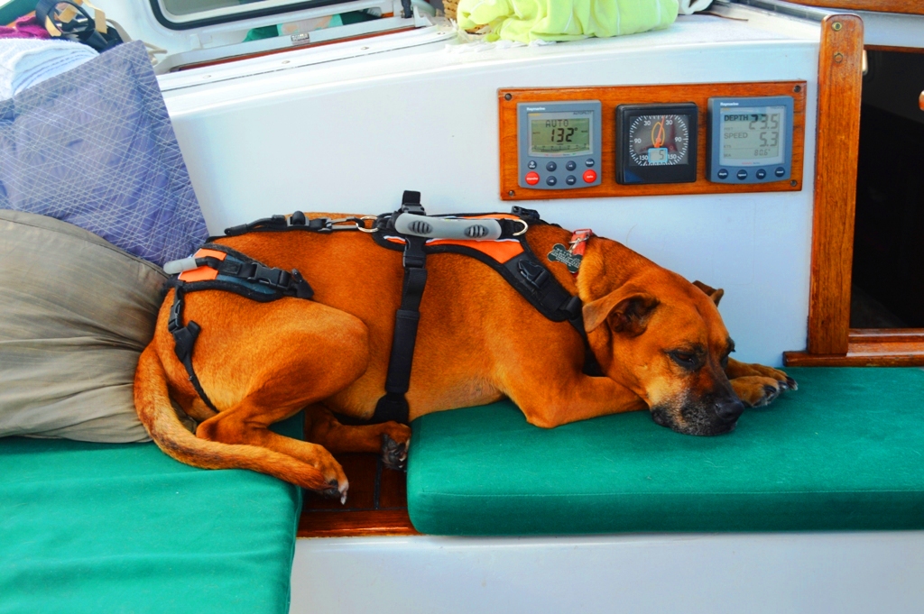
The requirements for bringing the dogs to shore in T&C was out of the question. The blood Titer test is mandatory, along with a USDA approved International Health Certificate. Both of our dogs are rabies-free, totally current on their vaccines and flea/tick/parasite medications, and have a clean bill of health and regular International Health Certificate. T&C had quite a laundry list of requirements for pet importation permits. (Future post in the works with all the details of what we have learned taking our dogs to each of the different countries). Revolution isn’t even good enough to cover their flea/tick/parasite prevention requirements! If we were to send out for the Titer test with USDA approval it would cost us upward of $800 for two dogs. Since we don’t plan on staying in any of the Caribbean countries very long, we opted to not jump through these ridiculous hoops. The dogs are just fine staying on the boat until the next time we reach shore. This country won’t be getting our money!

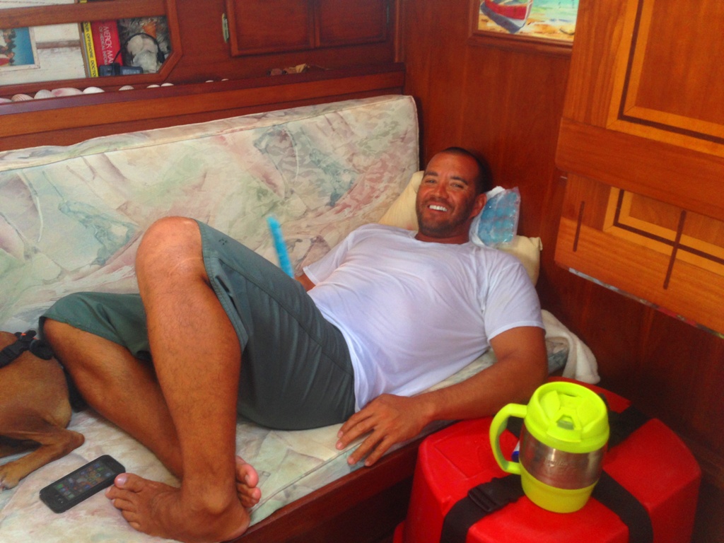
The heat was almost unbearable with zero breeze. We managed to find a little relief inside the cabin with ice packs on our necks and a few popsicles to cool our bellies. Our air conditioning requires the generator to be running and the generator is temporarily out of service. We will be doing some repairs once we reach the DR. Despite the heat, we soon fell fast asleep anchored safely just behind the reef in a welcoming patch of sand.

IMG_7443

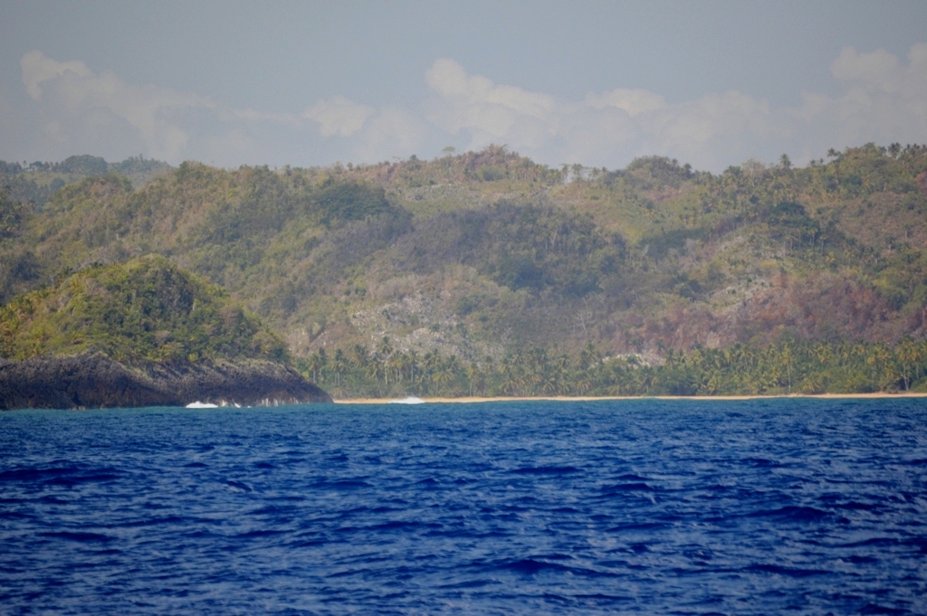
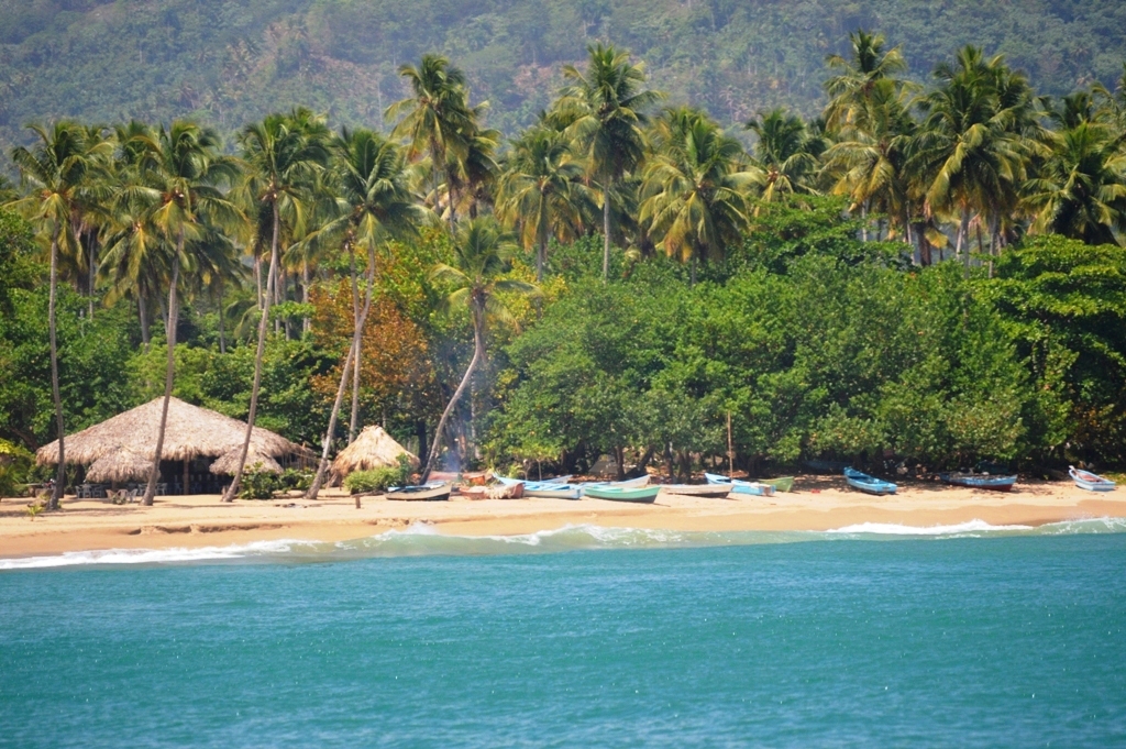
Later that afternoon the beauty of the turquoise blue reefs called us out to play. Peter inflated one of our Tower Paddle Boards for us to ride tandem out to the shallows not too far from the boat. Beyond that reef was open ocean and we could feel the colder water spilling in to mix with the 82-degree bathwater. We put on our fins and masks and towed the iSUP behind us taking a quick peek at the beautiful underwater world that neighbored us.

I felt much safer hanging onto the edge of the board after we both saw a reef shark lurking nearby. There was no real danger but it was nice to know I could pop up on that board anytime if we saw anything larger checking us out. The lingering trauma of our bull shark encounter still gives me the heebie jeebies!

We also saw several big snapper, a curious barracuda, a few lobster, pretty coral and a hundred different colors of little reef fish swimming all around us. There were blues and purples and yellows, oranges, reds and greens. Some were translucent and iridescent while others were bright and neon. Fish swam in and out of every nook and cranny of the coral.

DSC_0218DSC_0205DSC_0209DSC_0199

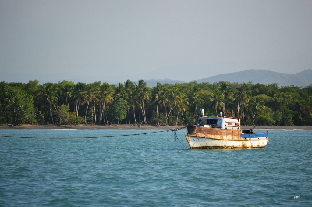
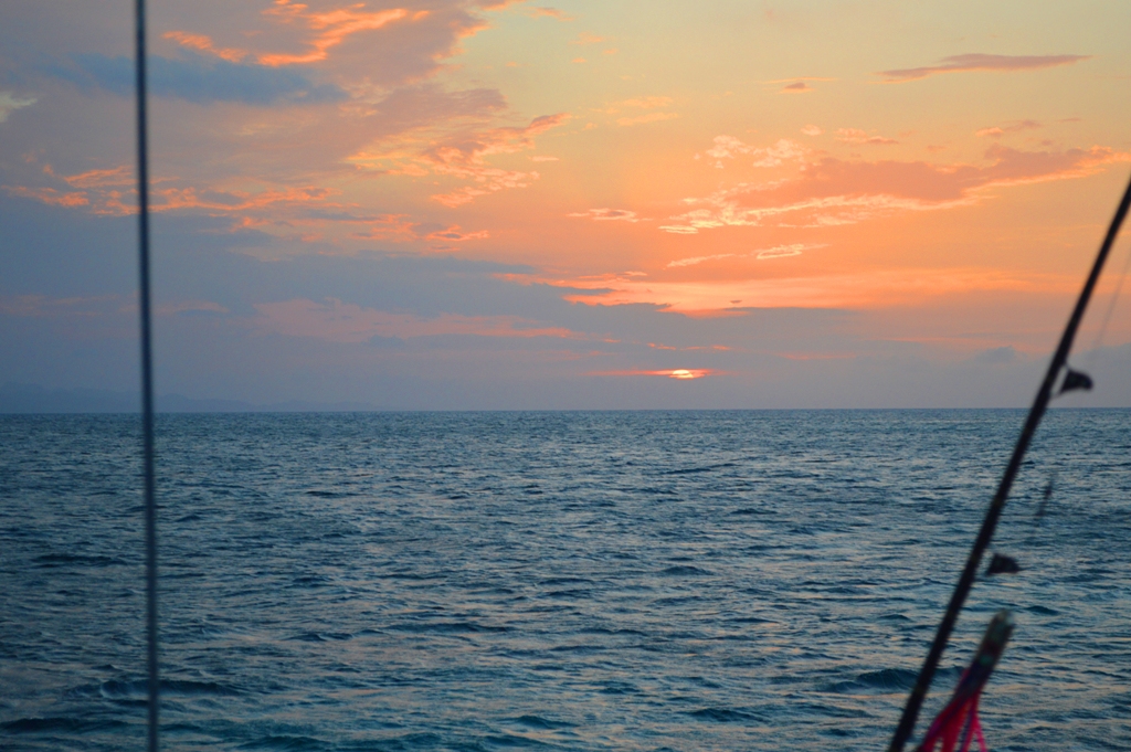
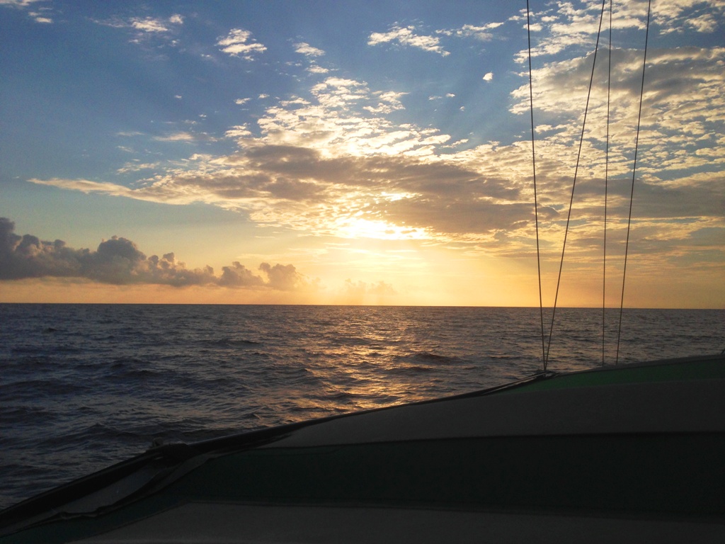
As the evening hours set in, we left West Caicos following our tracks around the reef in the dark. The only lights were our own. This next passage had us headed for the Dominican Republic.

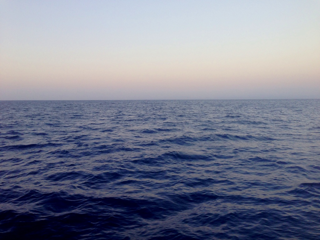
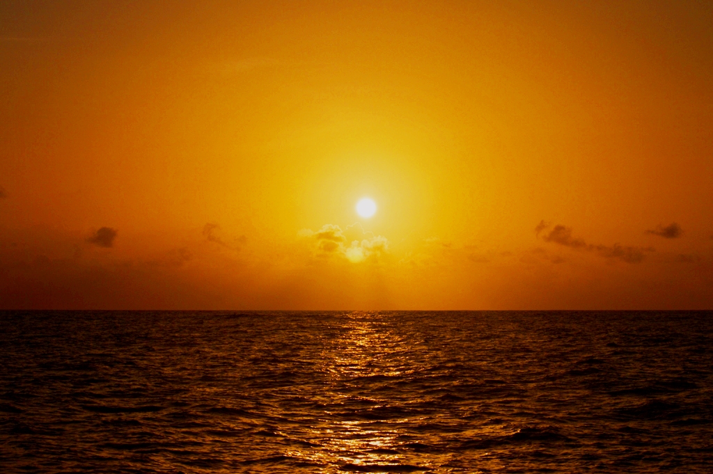
The Equatorial Current did a number on us, pushing a good 3 knots all night. The sun rose and another gorgeous day was upon us.

DSC_0374

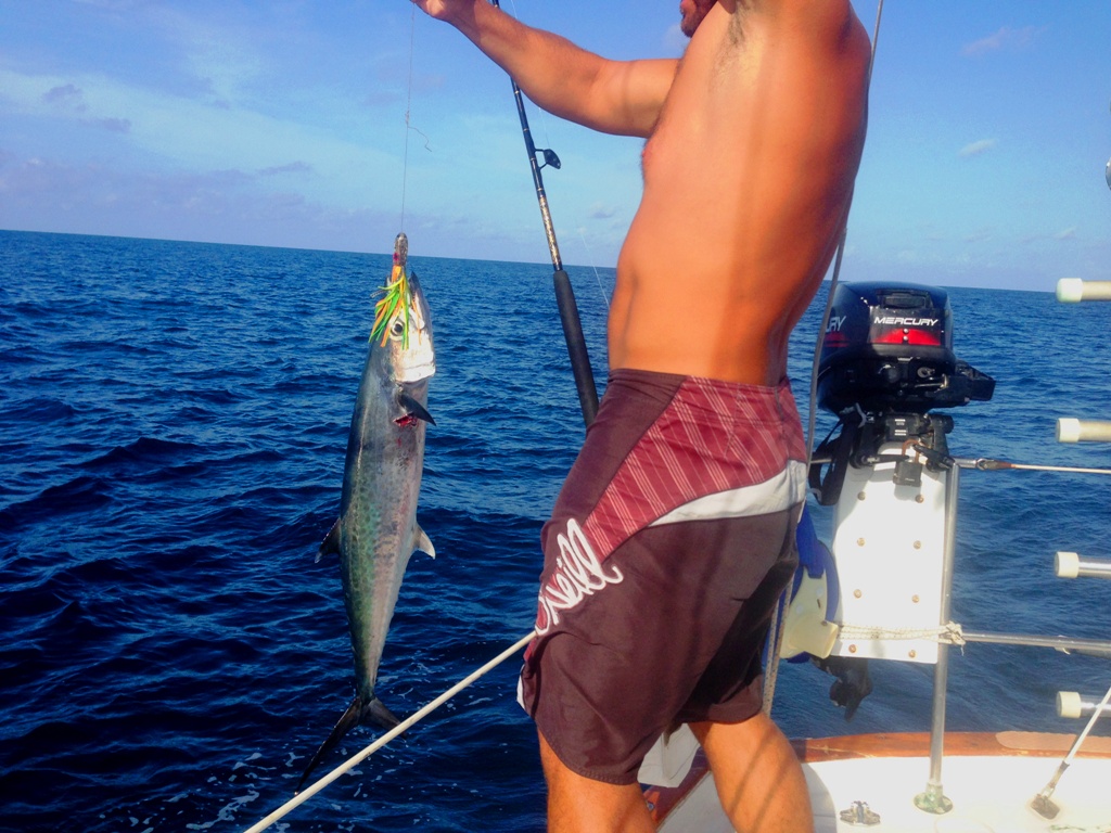
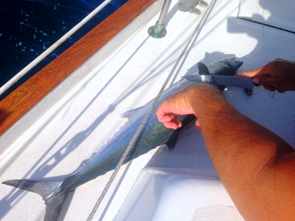
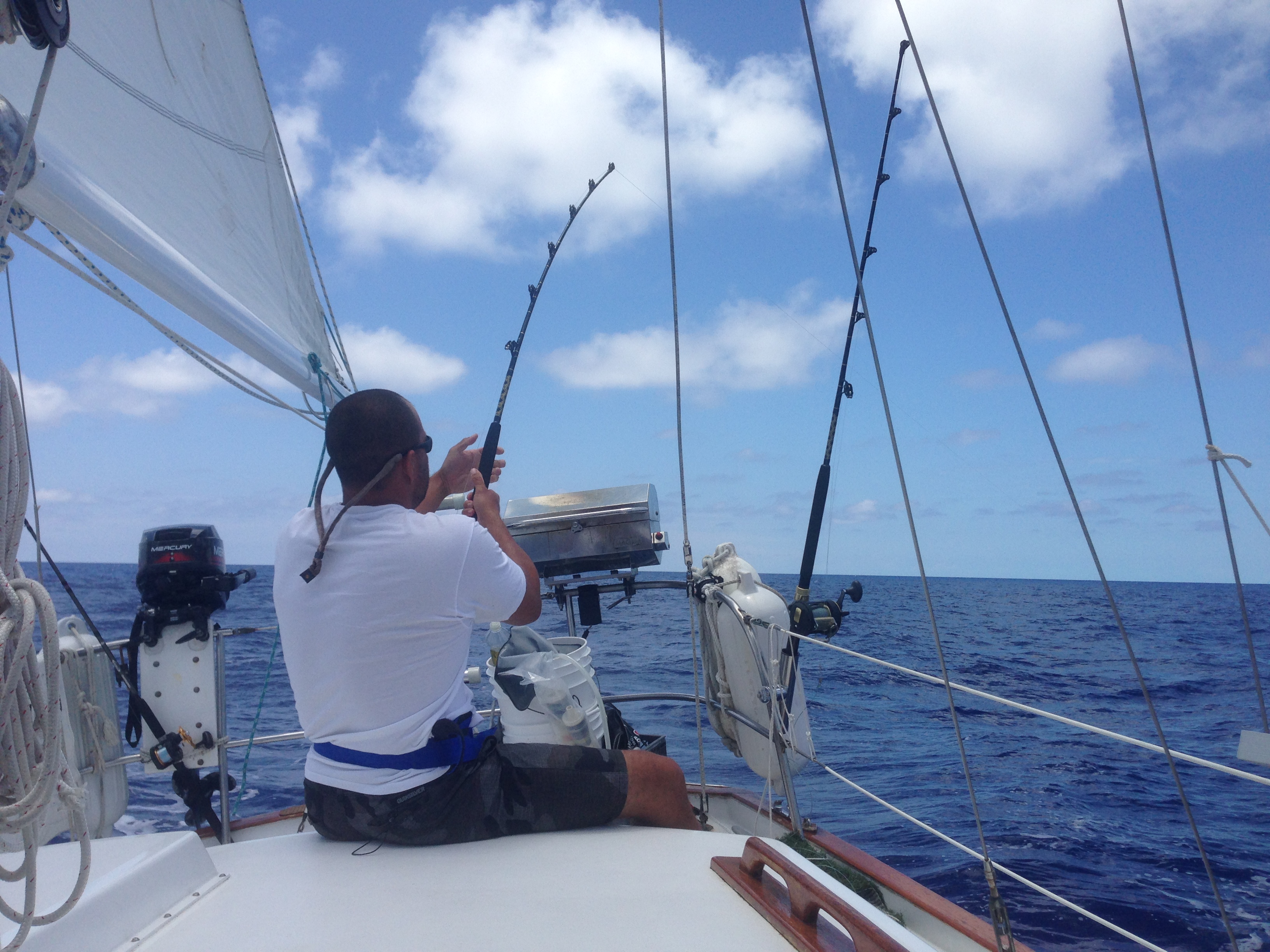
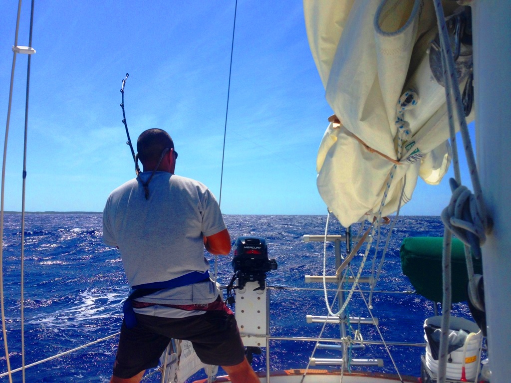
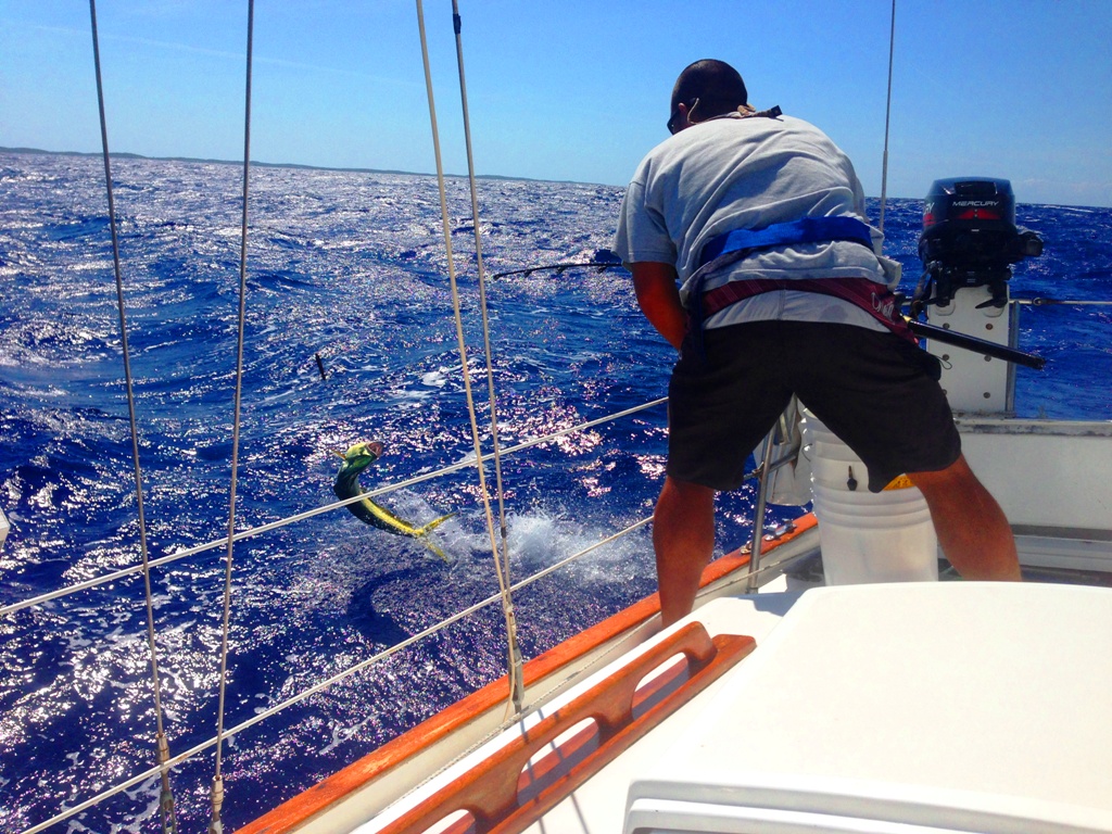
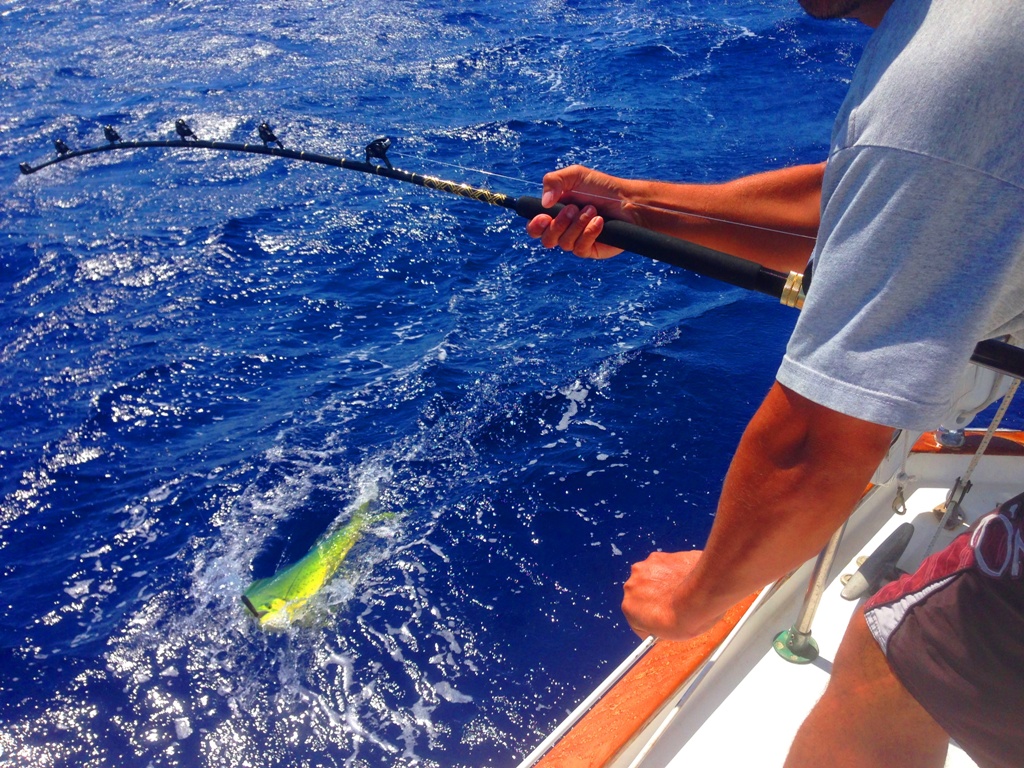
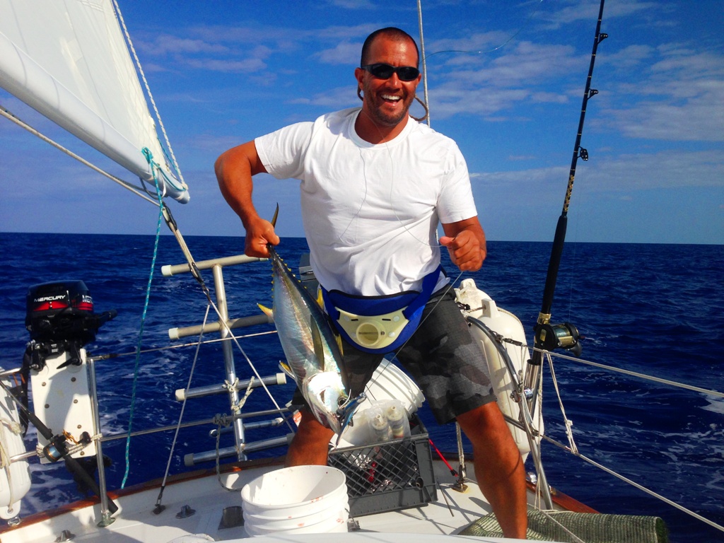
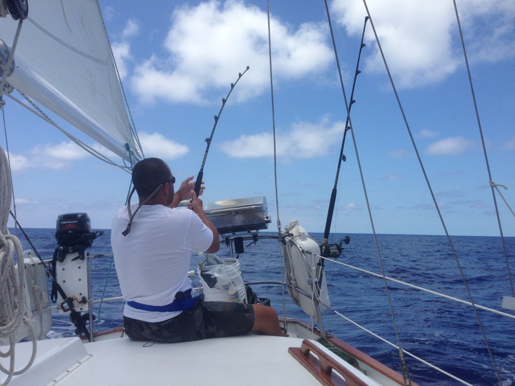
Within minutes of the lures hitting the water, Peter was hooking up left and right.

DSC_0228 DSC_0257

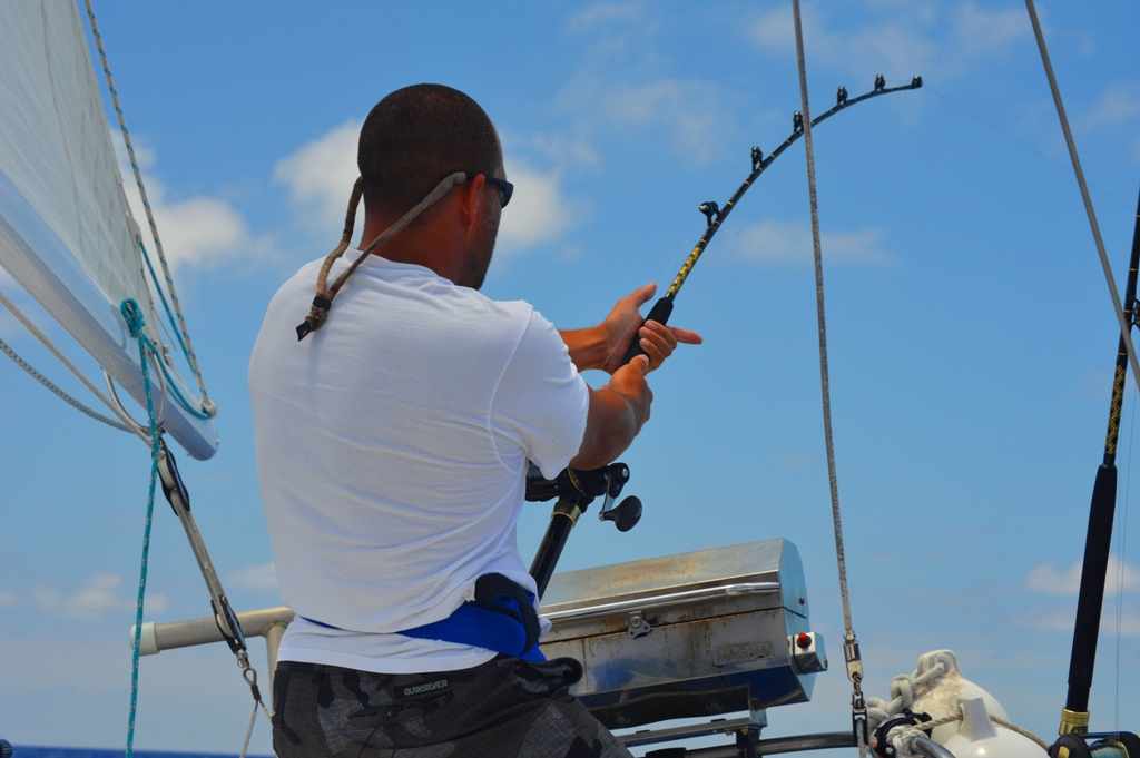
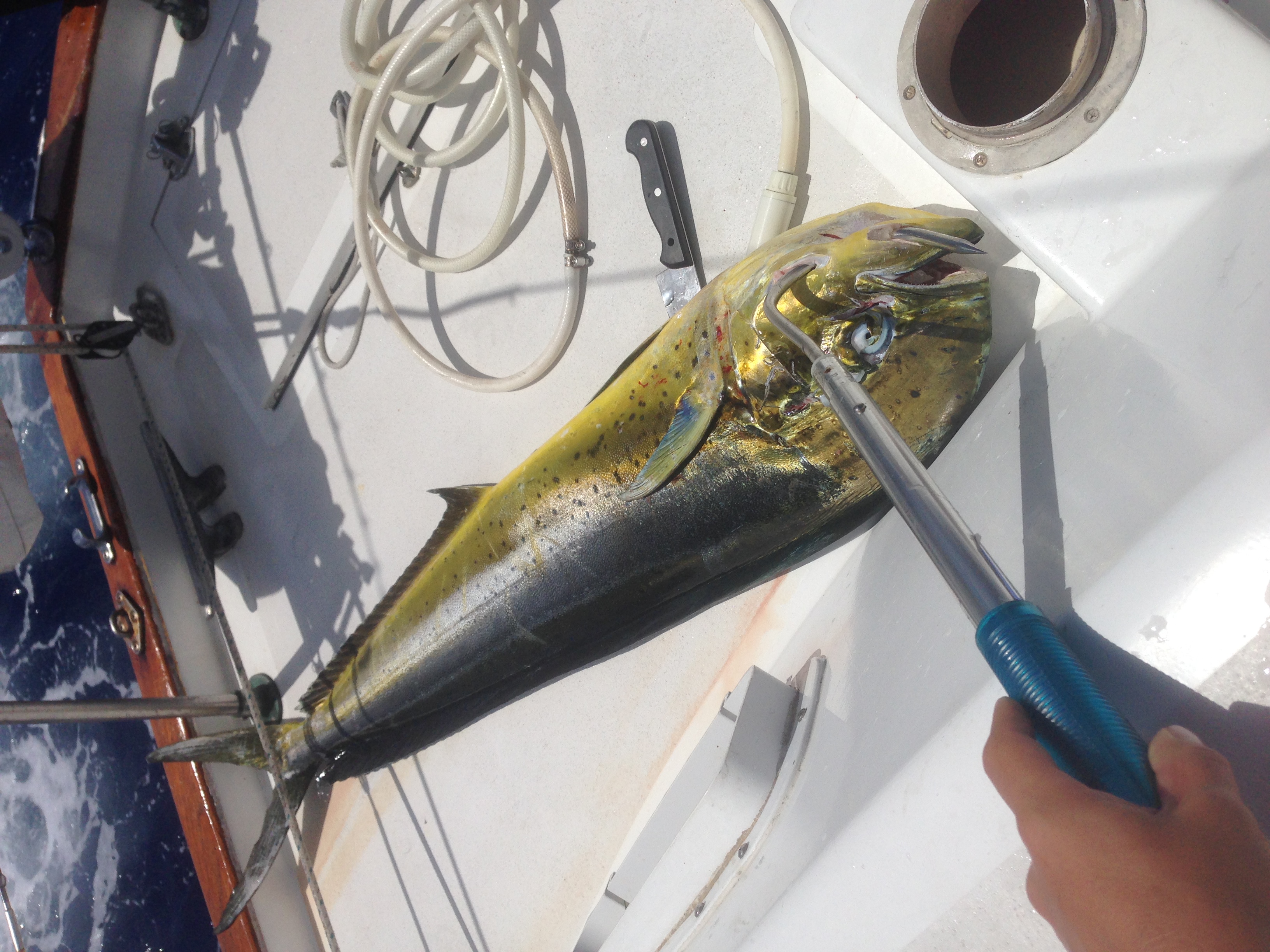
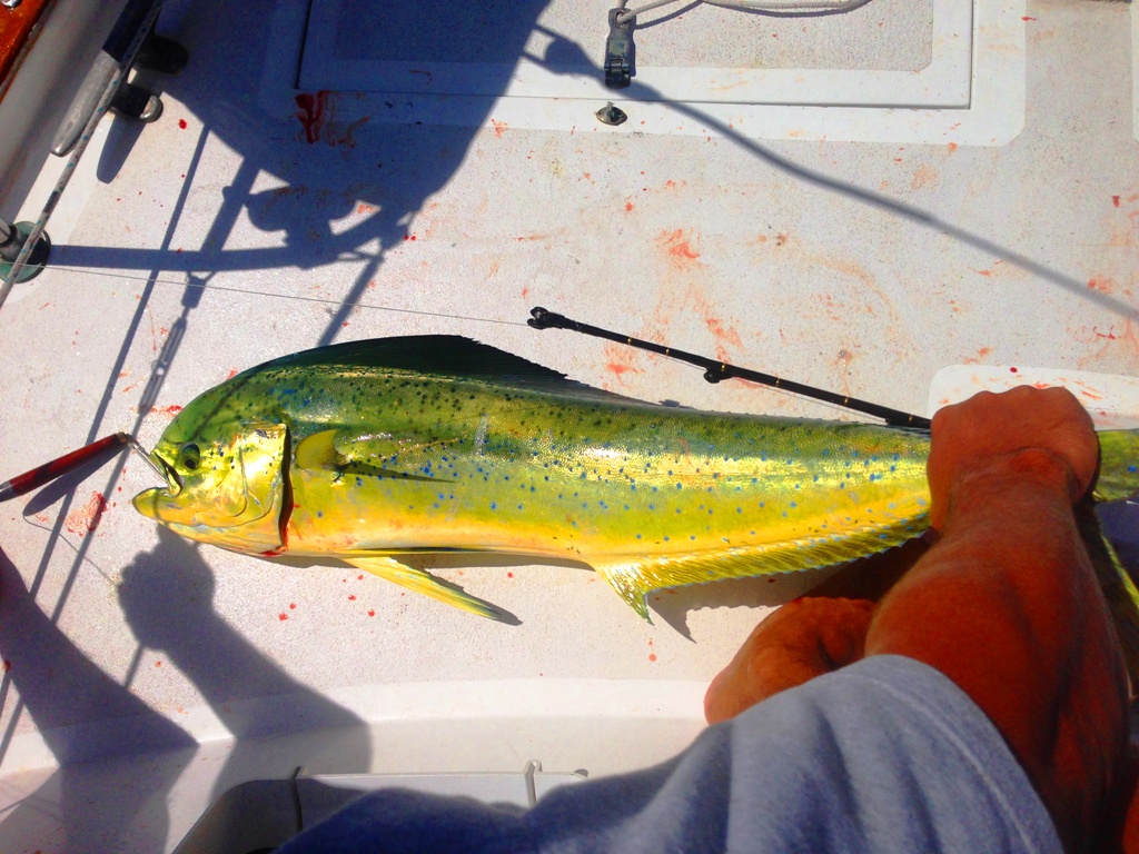
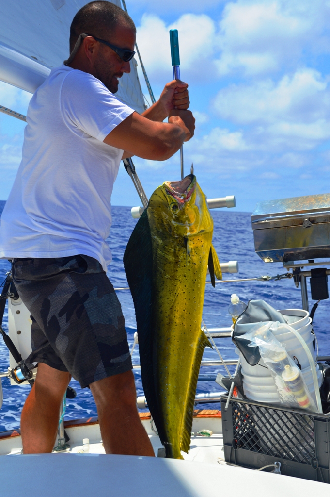
Our biggest Mahi Mahi yet…

DSC_0309

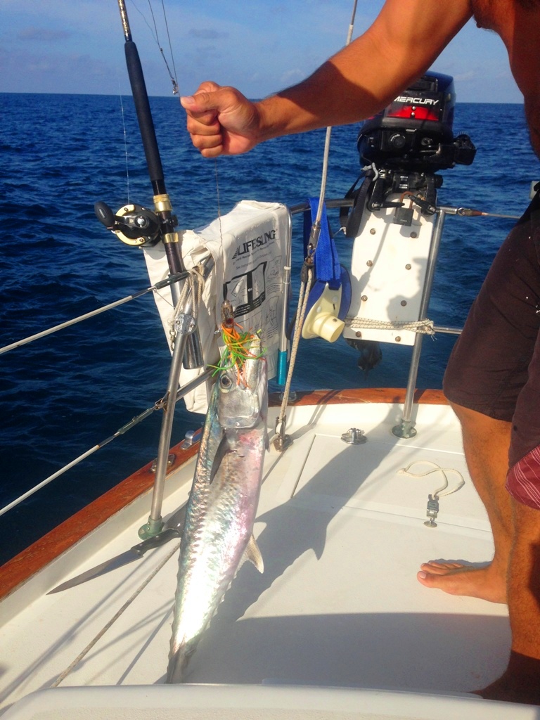
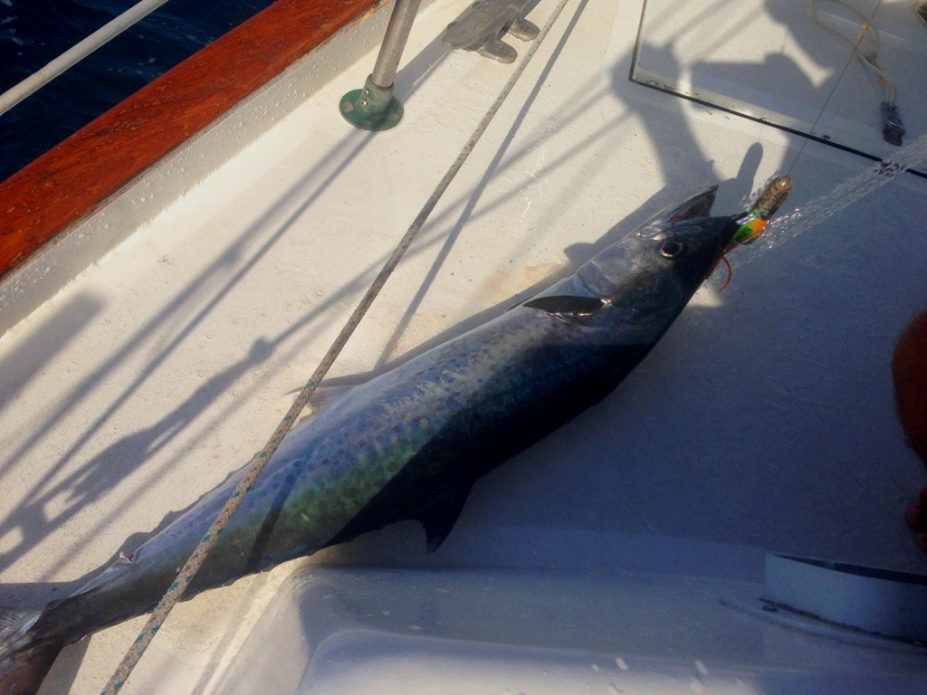
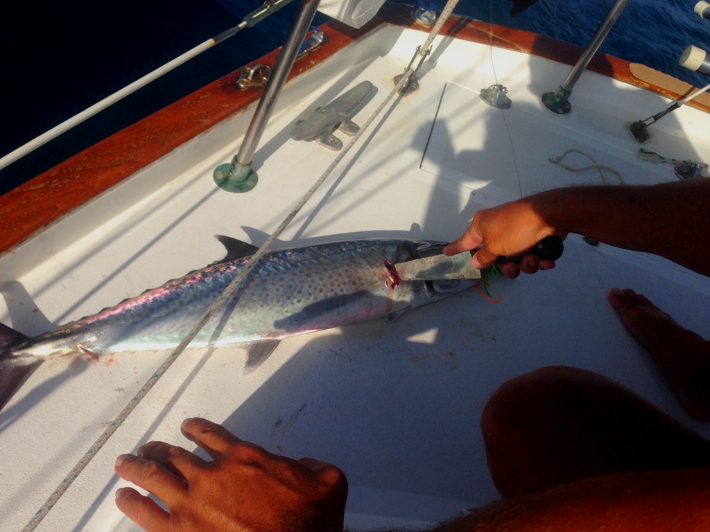
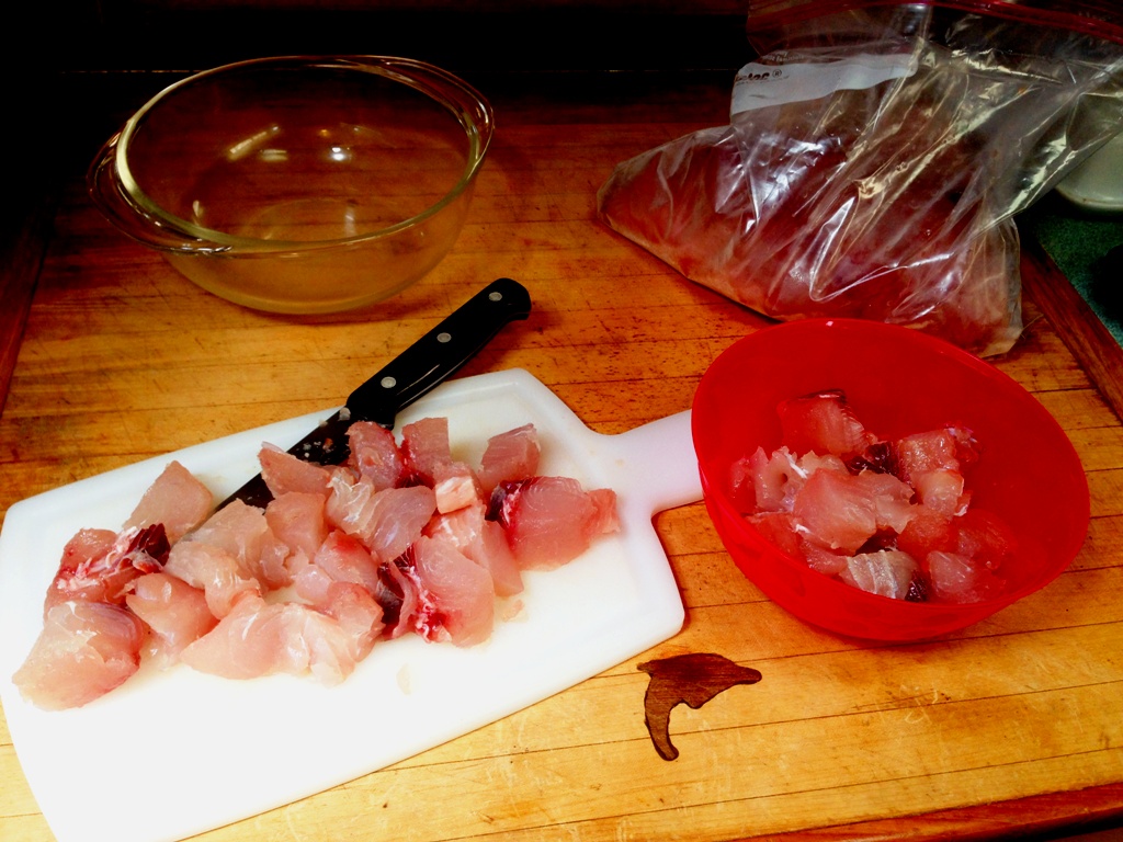
They kept coming. As soon as we fileted up one fish and cleaned up the bloody decks… “FISH ON!” Eventually we had to put the rods away. You can only clean so many fish in one day while underway!! The best part? Fresh sushi for lunch!!

IMG_7481IMG_7639

When Mahi Mahi die, they change color as they bleed out. Their scales turn to an icy blue, then back to yellowish-green.

IMG_7694IMG_7711

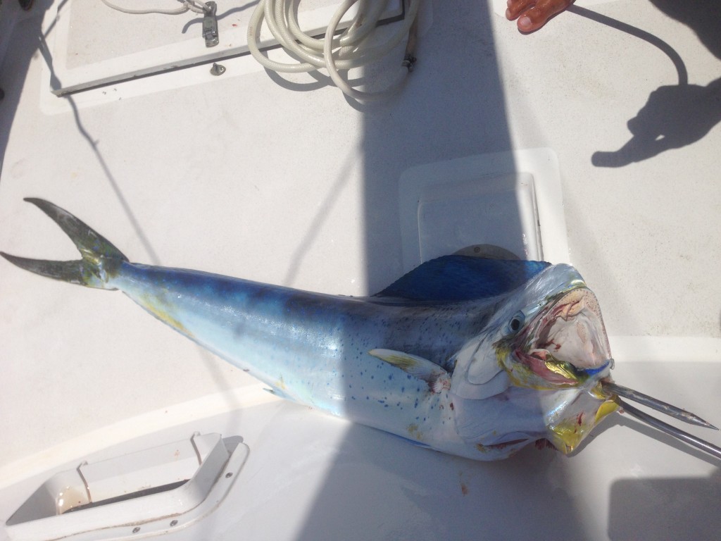
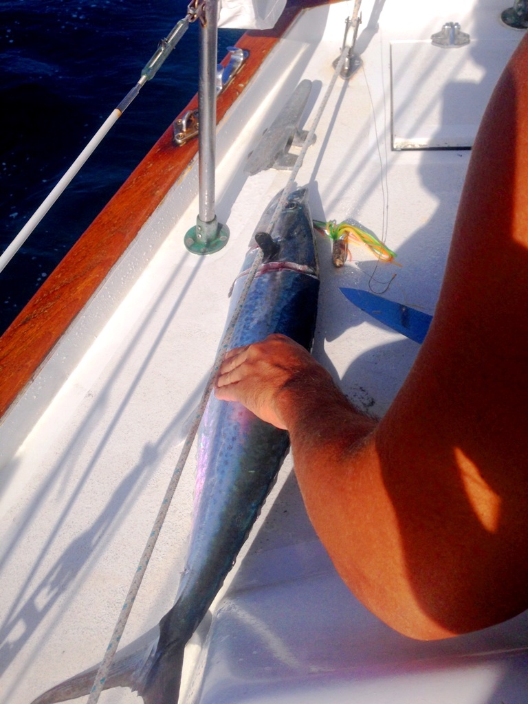
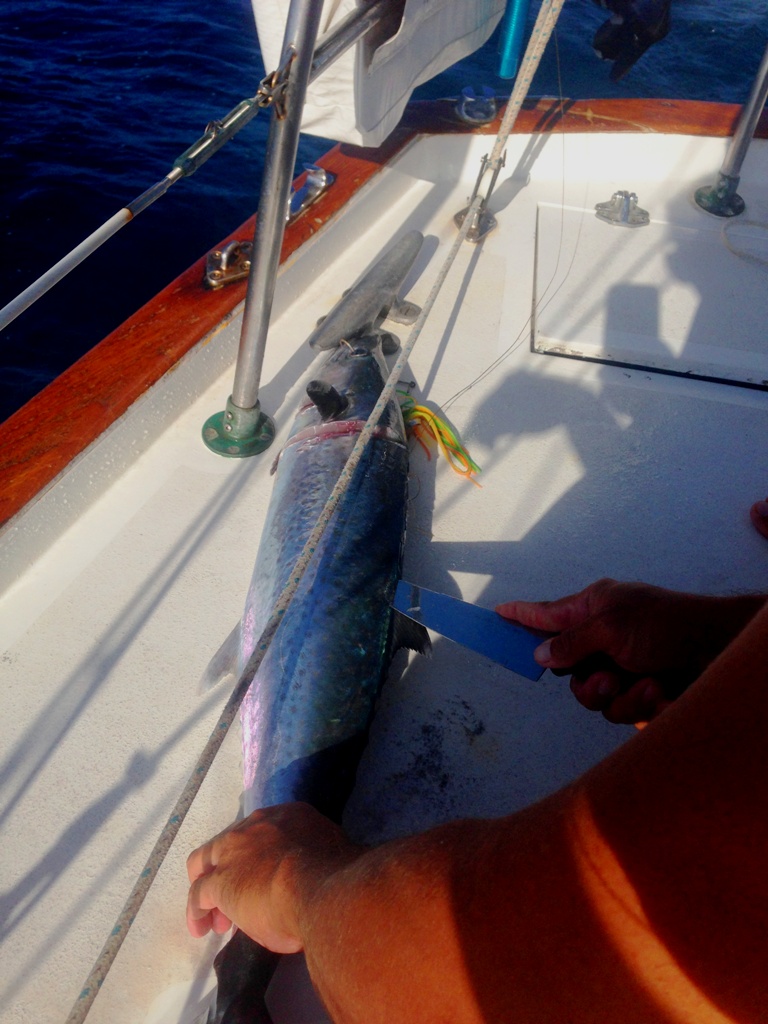
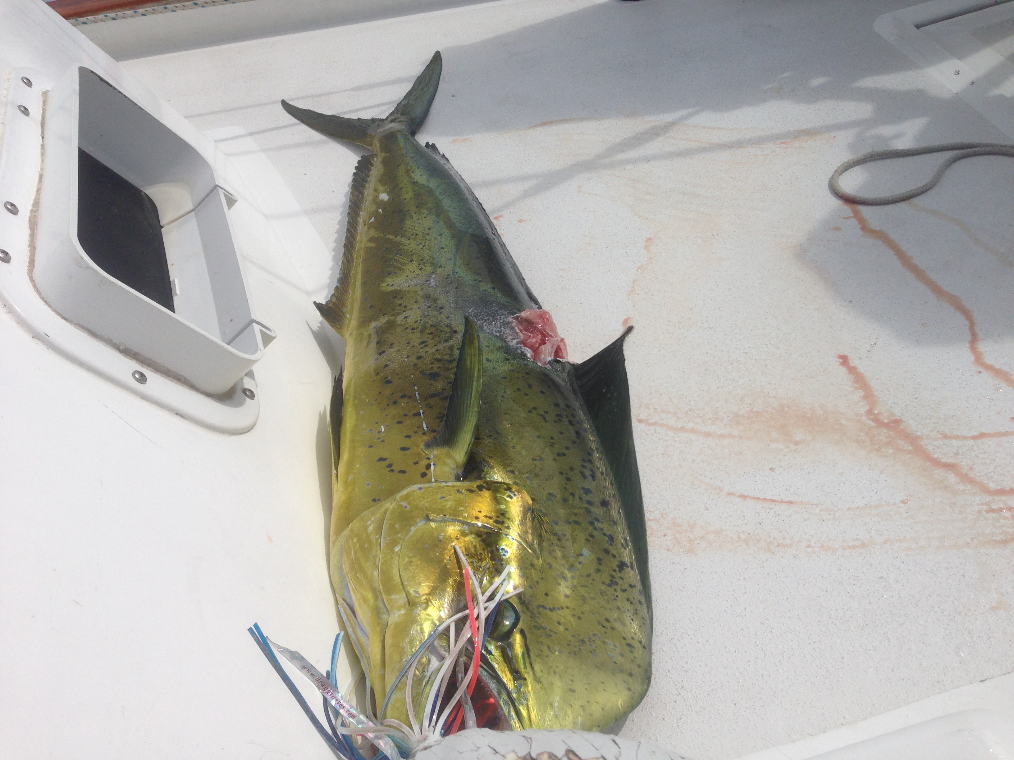
This poor guy got DOUBLE hooked on both of our trolling lines. Peter and I were each reeling in a line and by the time we discovered it was the same fish, a shark came up and whacked him!! It was pretty cool to see. This fish was destined to be somebody’s lunch that day :)

IMG_7726

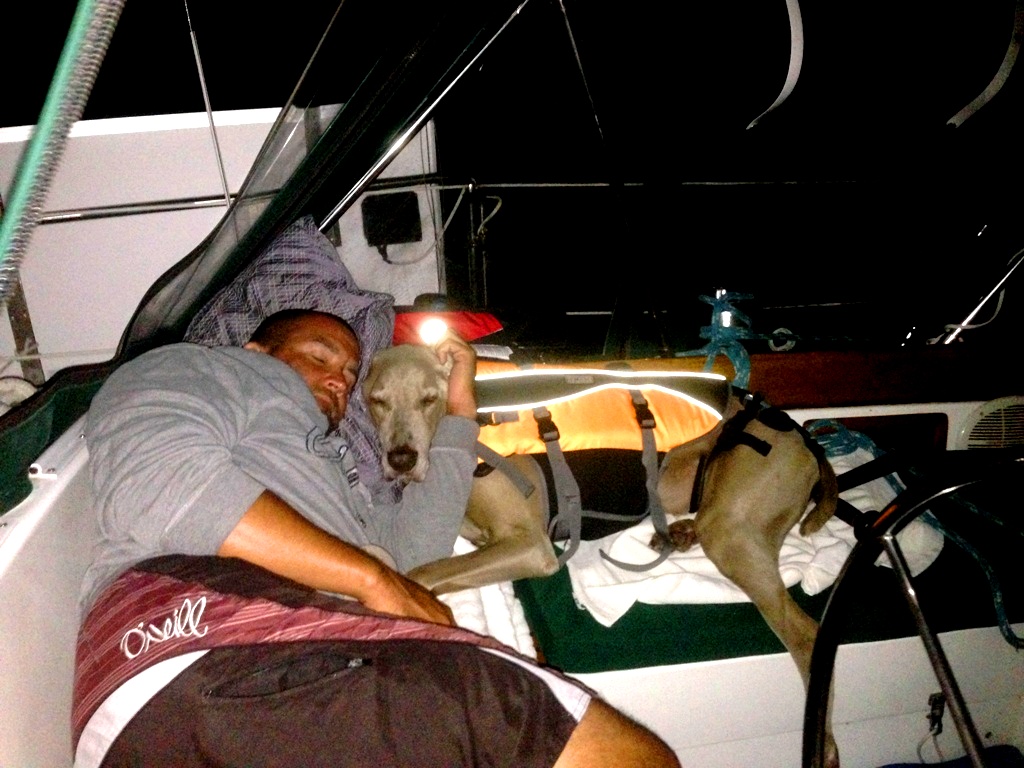
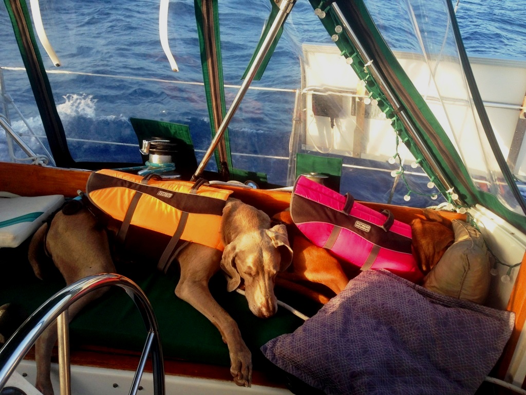
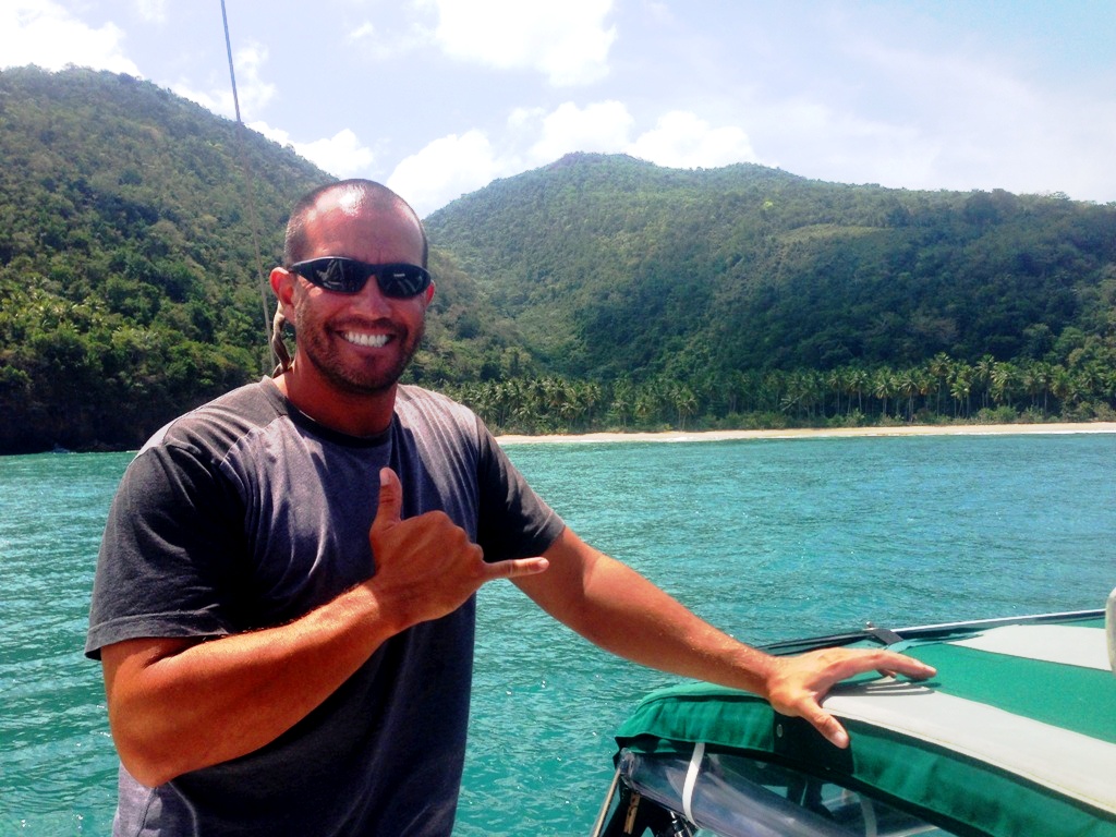
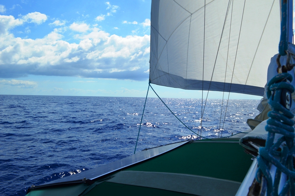
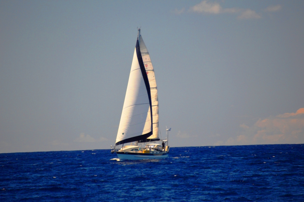
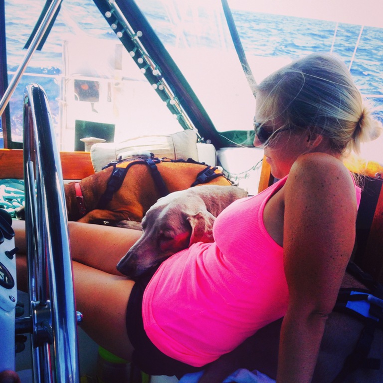
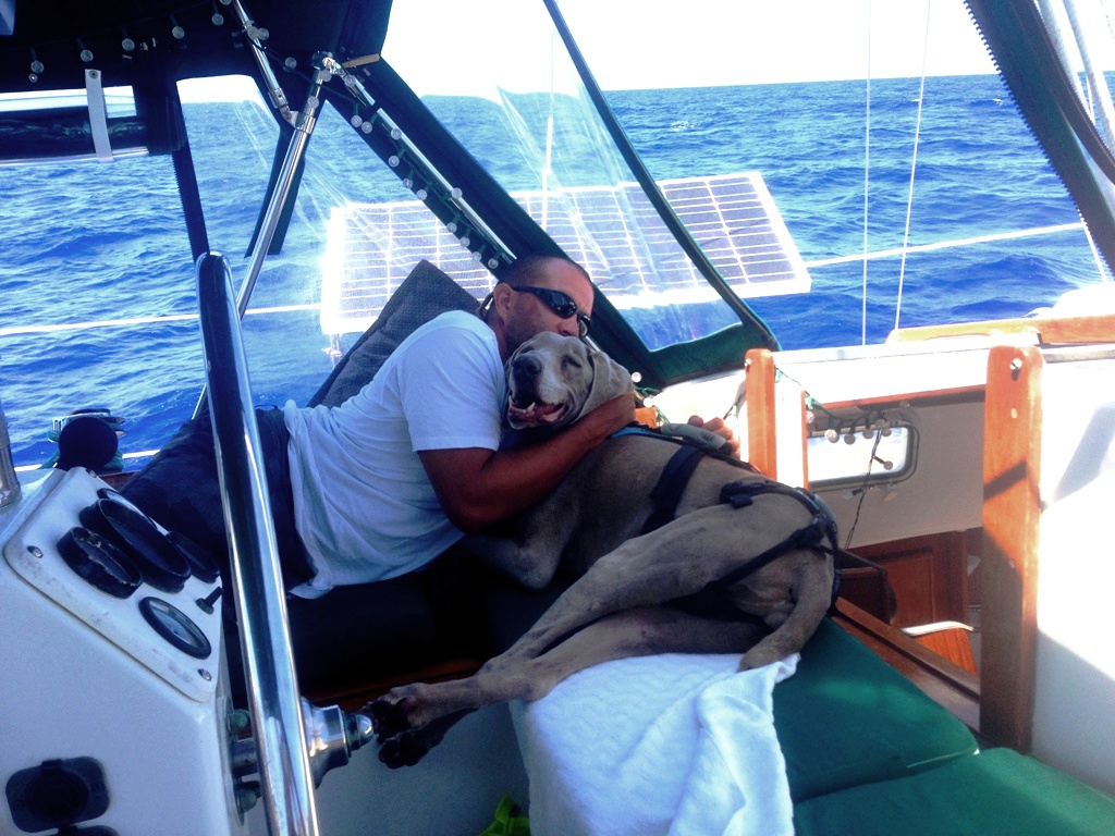
When the boys had their fill of fish for the day they cuddled up for a nice afternoon sail.

IMG_7616

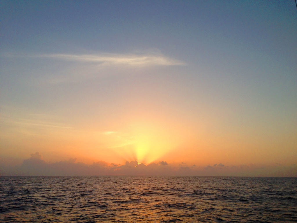
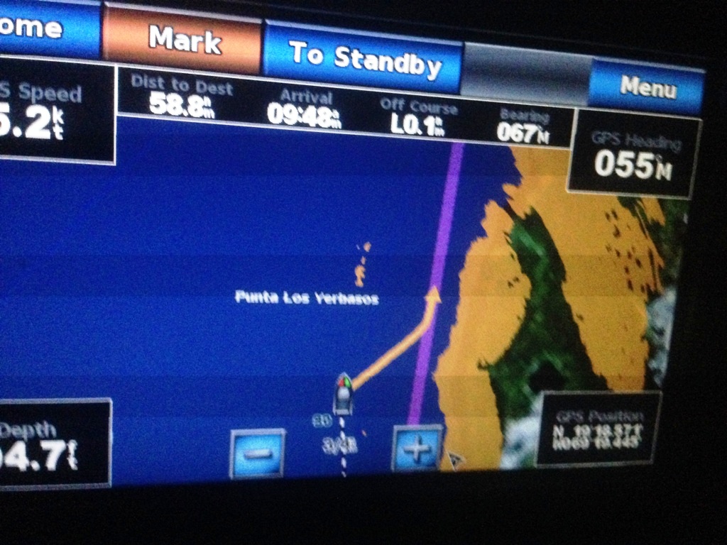
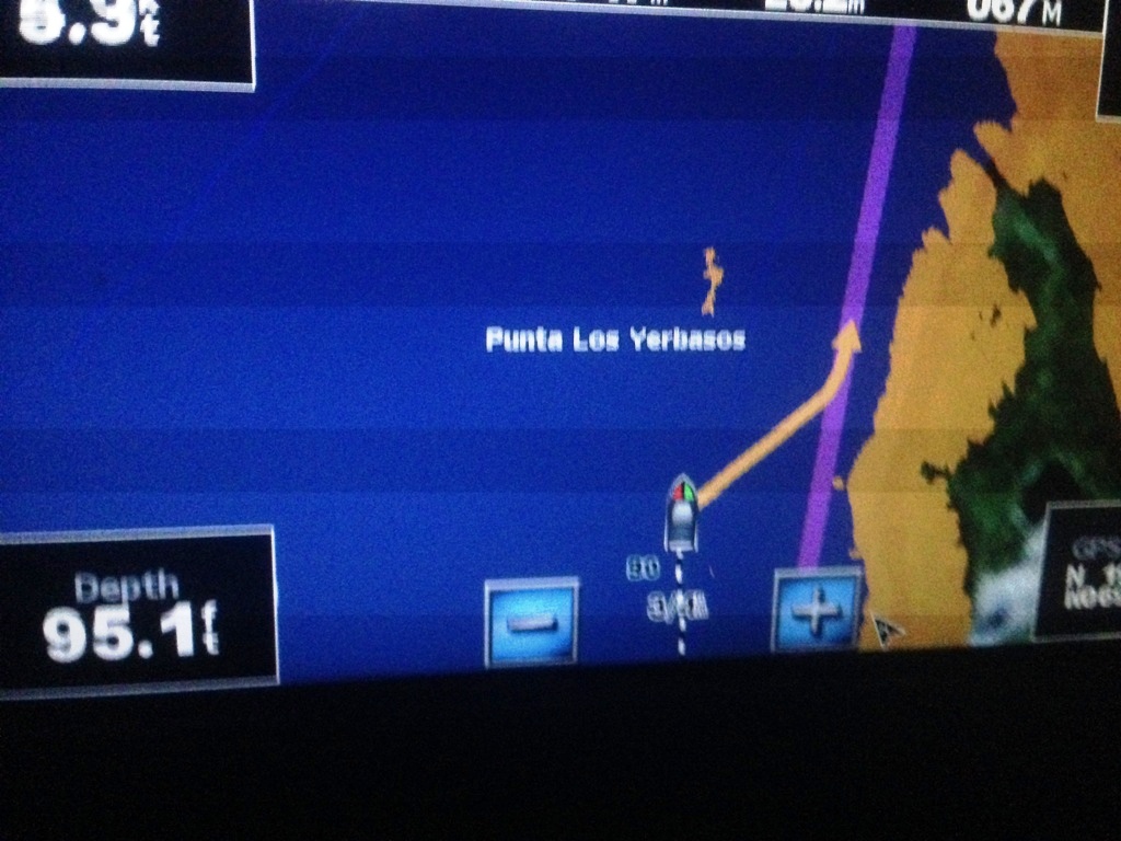
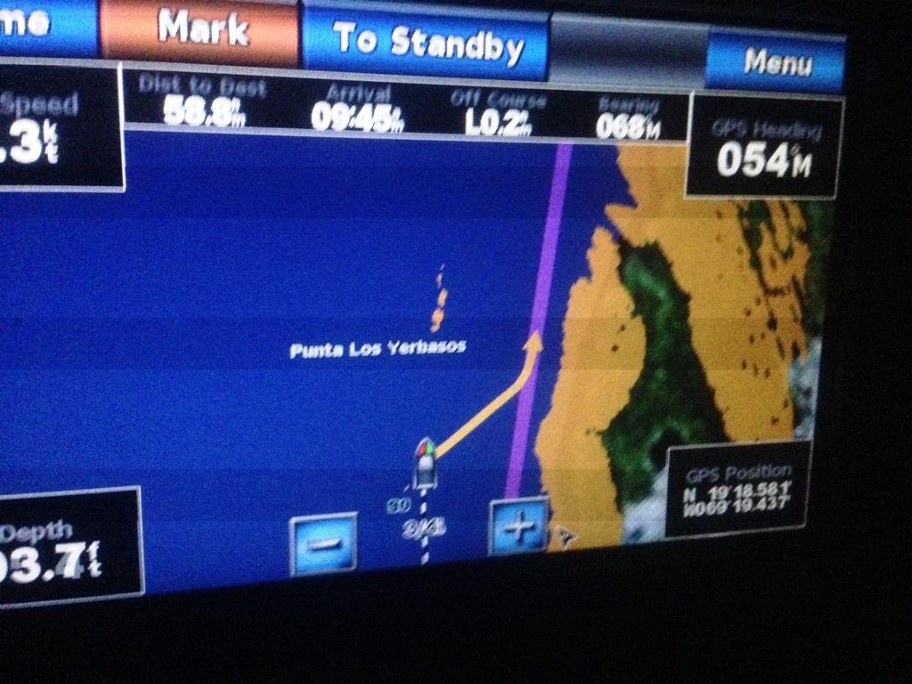
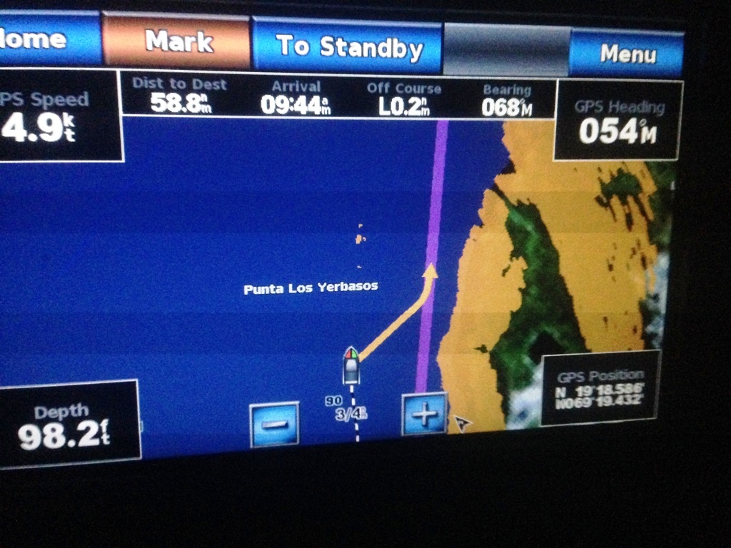
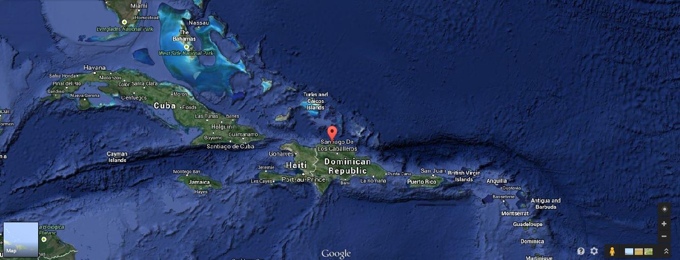
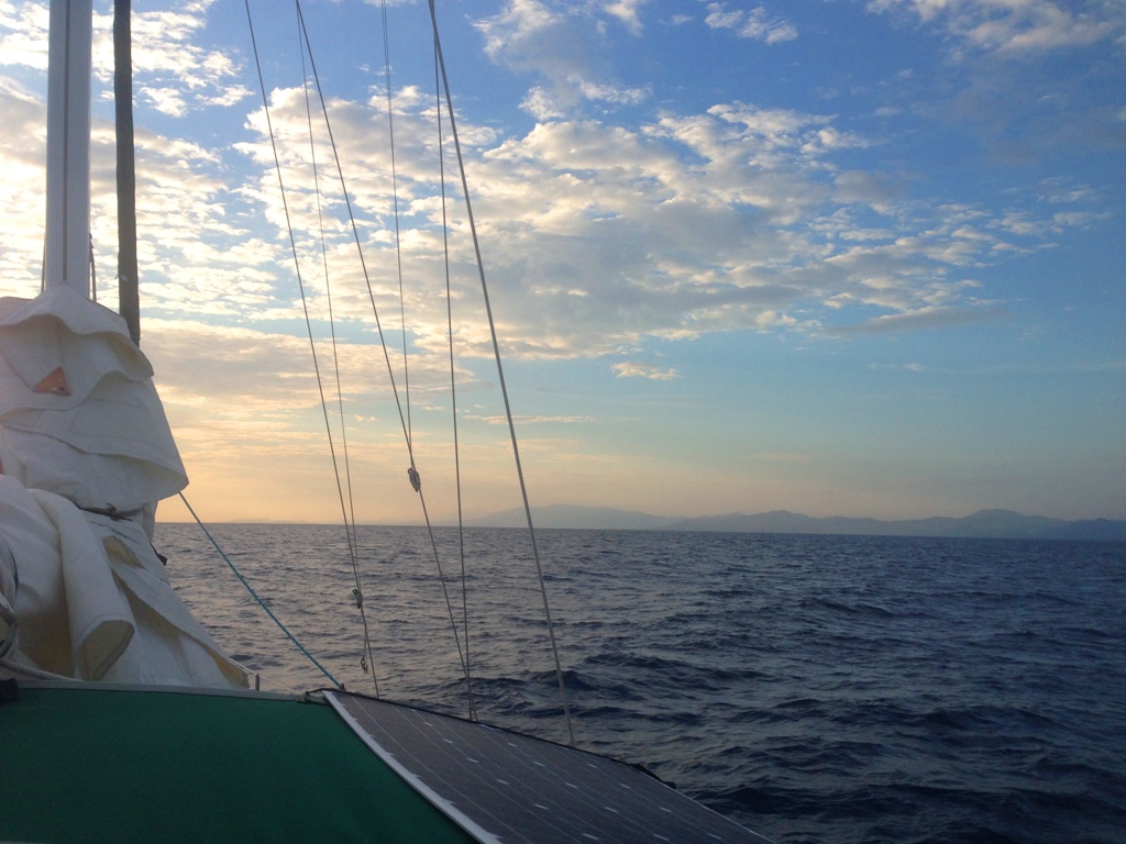
Our course was plotted for Luperon but as the current held strong, our ETA slowly pushed out from 6:00am to 11:00am. Thanks to recommendations from Bruce Van Sant’s A Gentleman’s Guide to Passages South, we adjusted our course a bit further west to a little bay called Ensenada. We could have pushed on for Luperon if we didn’t mind getting beat up. It was imperative we get anchored before the night lees die and the tradewinds pick up after 8am. The sunrise and glimpse of the mountains of the DR were breathtaking. Peter and I both had an overwhelming feeling of awe and gratitude for making it as far as we had.

IMG_7740IMG_7747

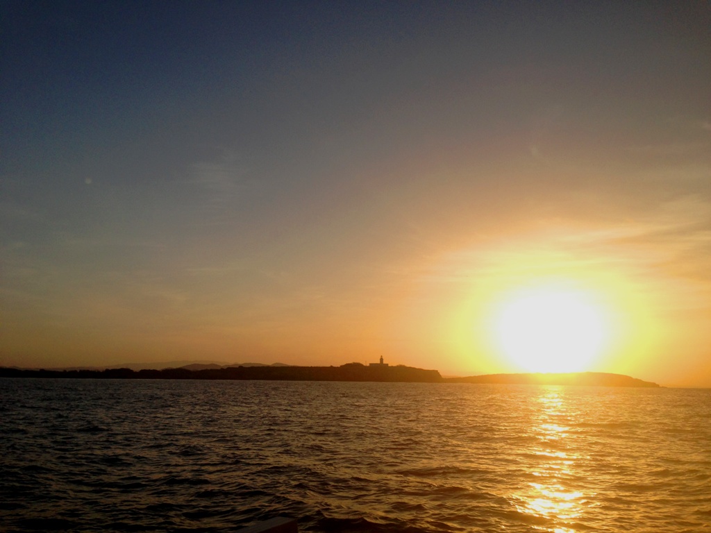
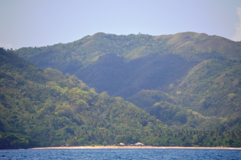
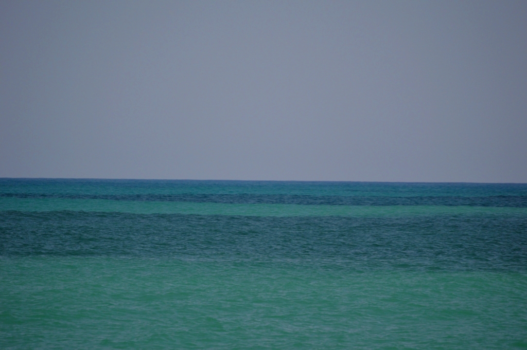
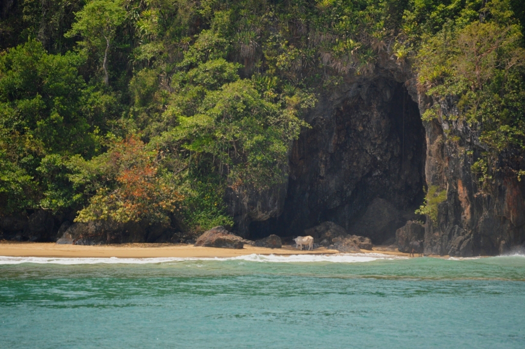
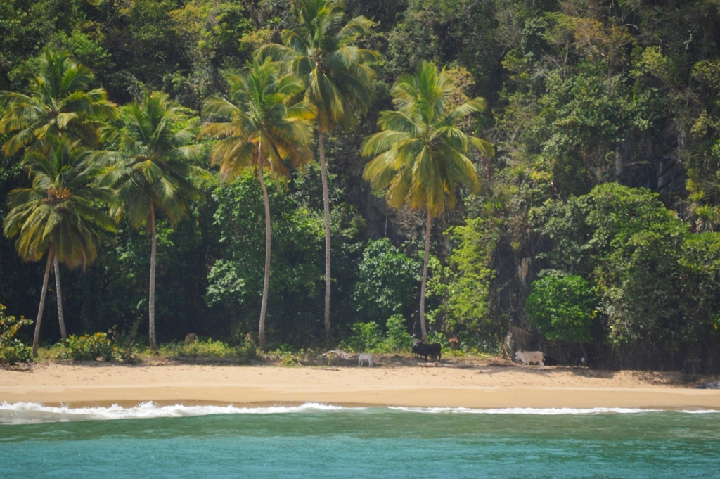
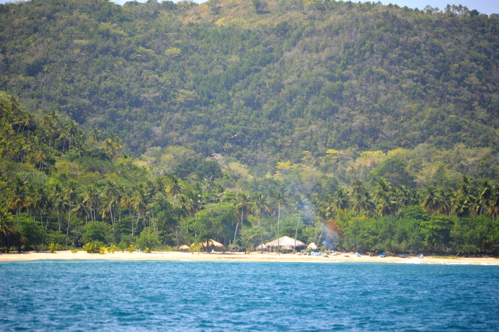
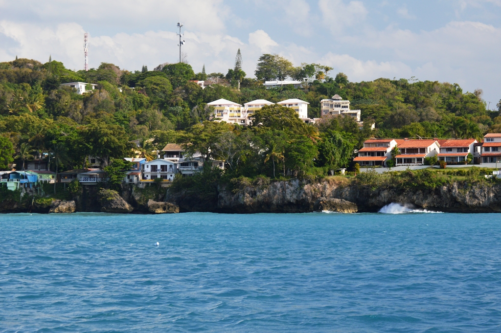
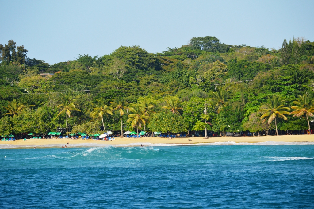
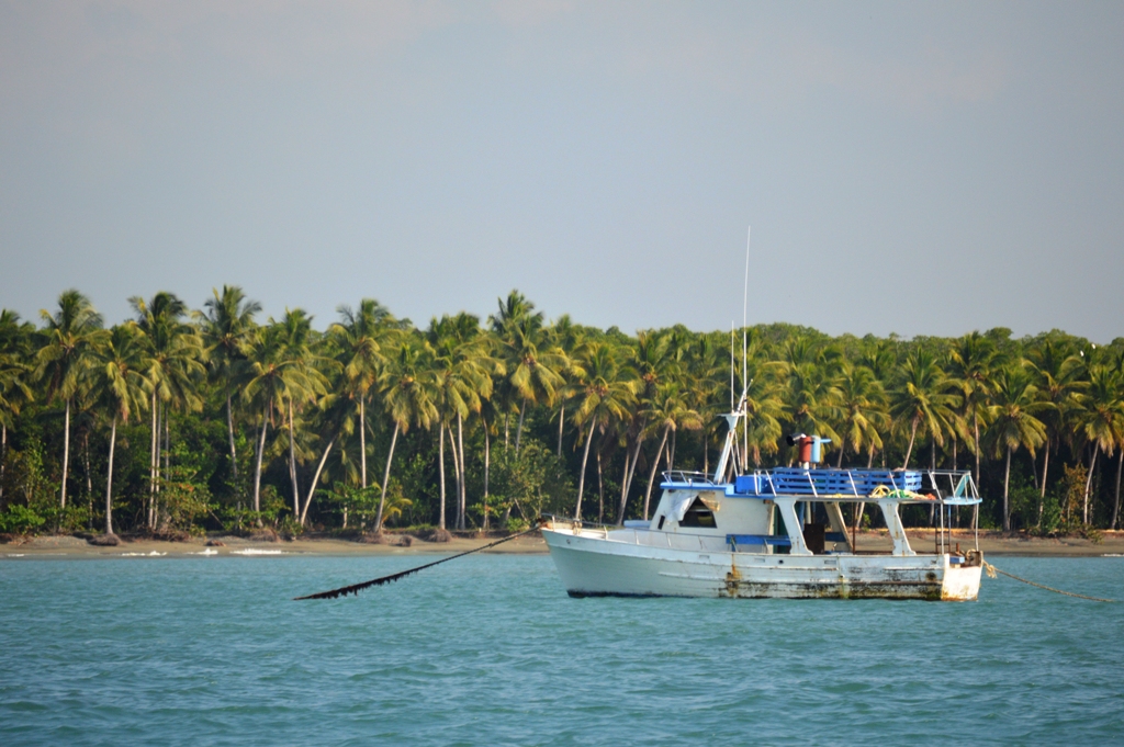
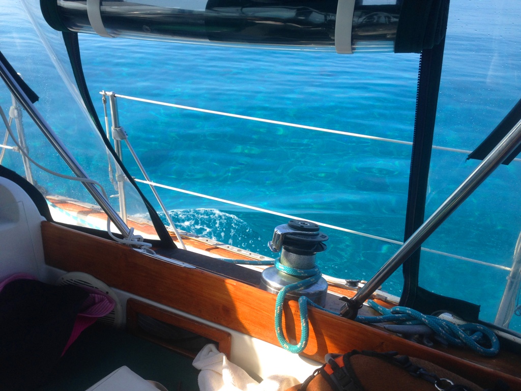
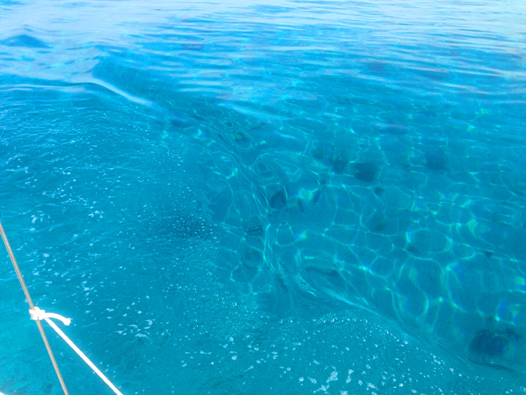
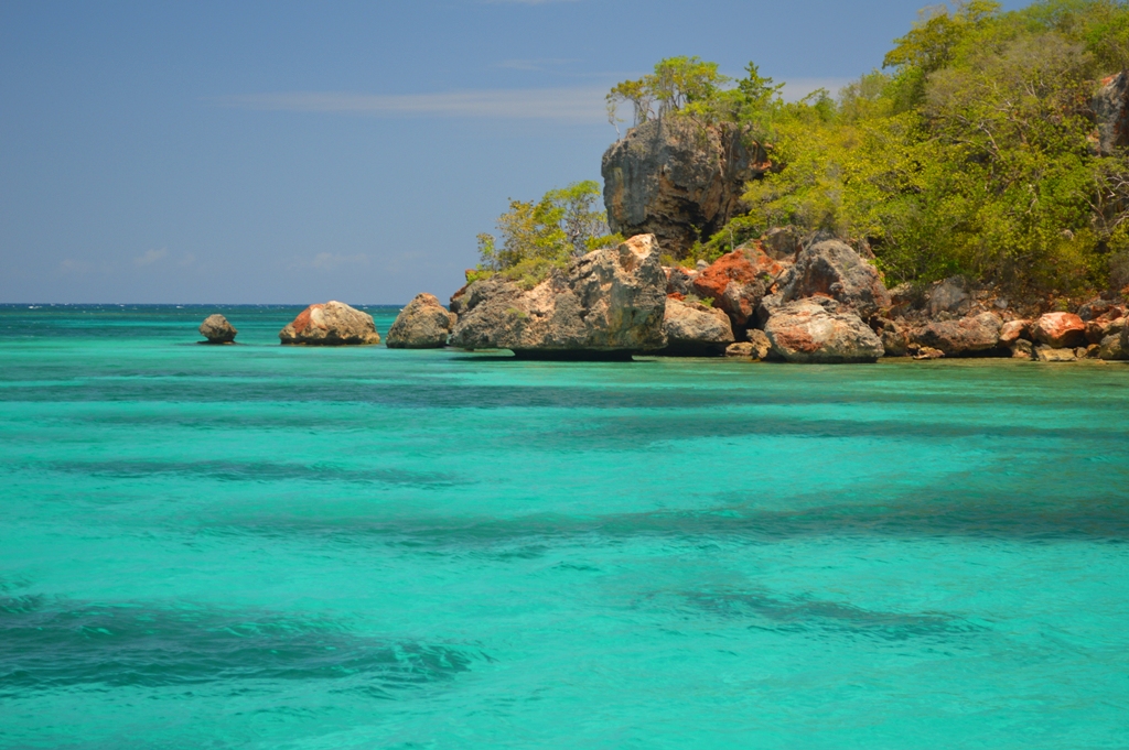
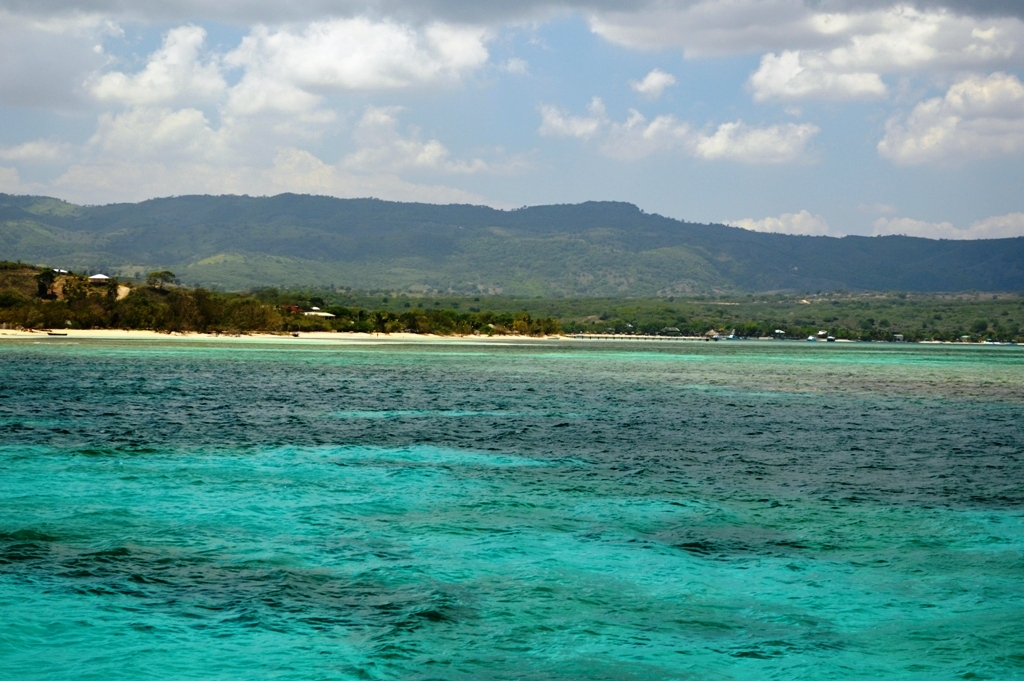
Ensenada is absolutely magical. One of our favorite anchorages, hands down! As we coasted in to the sleepy little anchorage, a hundred white butterflies engulfed our boat. The color of the water was spectacular. Clear and clean and the prettiest shades of turquoise we had seen in a long time. Birds were chirping and the sun was shining. We began wondering why it took us so long to get through the Bahamas!

DSC_0359 DSC_0370DSC_0360 DSC_0362IMG_7454IMG_7755

Ensenada is a secluded harbor on the north coast in between the official ports of entry of Manzanillo and Luperon. Punta Rocia is the name of the village and the local Coast Guard came out to greet us. They informed us we could not stay long because they didn’t have the ability to clear us in. We were allowed to rest for a few hours and leave as soon as the winds let up. They asked us to leave by 6pm but we stayed on for a few more hours after they were off duty. They didn’t seem to care that in order for us to arrive at Luperon in safe daylight hours, after sunup but before 8:00am, we had to wait to leave Punta Rocia at 9:00pm or later. In any event, the coastguardsmen of this remote village were very laid back and polite nonetheless.

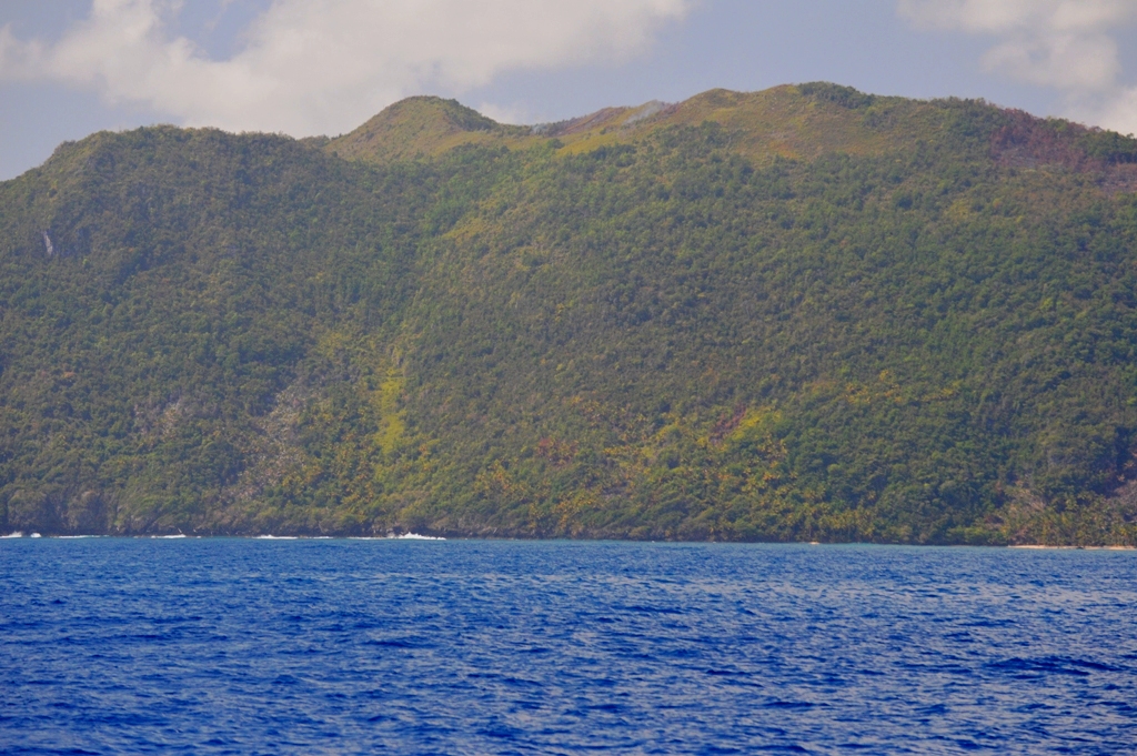
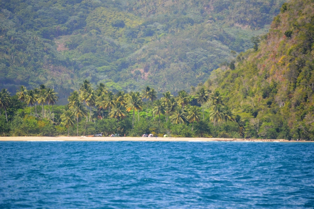
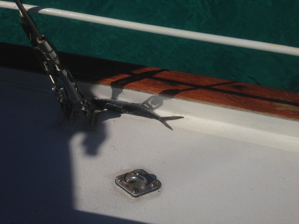
We enjoyed a refreshing swim and explored the surrounding coral. Betsy and Gunner were happy to be standing still at anchor again. On her first patrol, Betsy discovered a stowaway… another flying fish landed on our decks while underway. We saved this little fishy for bait.

IMG_7764

A nice afternoon nap was just what we needed after our long journey. HELLO DOMINICAN REPUBLIC!!

A SAILING Experience: Bahamas to Turks and Caicos

Monday morning 4.21 we pulled anchor at 8am in George Town after making breakfast, coffee and getting through our morning routine with the dogs. SV Krow was about 20 minutes ahead of us. We navigated out of the harbor south from San Dollar Beach and watched anxiously as Krow’s mast flung wildly back and forth like a metronome as they made their way into Exuma Sound. If the waves were rocking a 50′ Valiant that much, we would surely be experiencing more action than that very soon.

Previously satisfied with the way everything was stowed below deck, I did one more sweep of the entire boat to triple check that nothing would go flying. The dogs were happy and looking around. Peter put us on course to the northern tip of Long Island.

2-3′ seas and 10-12 knots carried us away into Exuma Sound on a beam reach with all sails up. The motor was off and all was great.

DSC_0073

Rounding the northern tip of Long Island got a bit scary. The winds picked up to 15-20 knots with gusts of up to 25. The seas quickly grew to a relentless army of 5′ waves with the next charging at us right after the last as we traveled downwind. Another reminder that “when it’s time to reef, it’s too late”…

Sailing in conditions like this is new to us and we had a heck of a time getting the boat back under control and getting the sails down. 5′ following seas in 20 knots was just too much for us to keep any sails out that day so we turned the engine on, pointed straight into the pummeling waves to get the main and mizzen tied down. Peter had to bring them both down by himself since there was no way our autopilot was going to let me get away from the helm. It took every ounce of concentration I had to keep us dead center into the waves. As each one crashed over the bow my knuckles grew whiter and whiter. Peter was out on deck doing a fantastic job tying up the sails despite the stormy conditions. The whole ordeal took us about half an hour.

We were finally ready to fall off the wind and make a 180-degree turn to port. Mary Christine flung around like a ragdoll as we got back on course. The smallest slip of the hand or over-correction of the wheel would push us back broadside to the waves as she yearned to point dead into the wind. Every second had to be anticipated. All afternoon we held our compass heading and steered by our peripheral vision watching the rolling waves sweep under our stern gushing toward the bow.

Of course it wouldn’t be a passage if our fishing lines weren’t out. The zinging of the reel quickly changed our mood from high anxiety to bubbling with excitement. We landed our first Mahi Mahi while aboard the Mary Christine. It as about 20 lbs, not too bad! Somehow the fear fo the 5′ waves slowly disappeared as I helped Peter filet the fish on deck. The autopilot held well enough now that the winds had died down a bit. This fish would give us 5 meals each with plenty left for the dogs.

IMG_7329IMG_7381IMG_7348IMG_7377

That night as the sun went down, we pulled further and further away from Long Island towards the Crooked Islands. The swell grew and the waves rose from 5′ to 8-10′. Eyeballing the steering was no longer an option as darkness engulfed the boat. I couldn’t see the waves sweep underneath us anymore which meant we had to rely strictly on our instruments and feeling the waves. At 5′ it was hard to “feel” our way downwind. Luckily, our course happened to be dead on downwind all night long.

We slept in shifts, sometimes two hours and sometimes three. We held our shift until we couldn’t stay awake anymore. Staring at a chartplotter in the dark is a little like driving on a lonely county road at night. Boredom sets in and it becomes hard to see with tired eyes.

As the sun came up the next morning the seas were much calmer. The gentle rolling of the ocean surface rocked us slowly. The weather was perfect with moderate winds and sunshine on our shoulders. All three sails went up and we made great time. We were just far enough away from our buddy boat SV Krow to not be able to see anyone or anything all around us. The overwhelming feeling of peace and serenity set in. The wind filled our sails and the sun kissed our faces. Mary Christine glided through the waves effortlessly and silently. All that could be heard was the cool ocean spray refracting off the bow. The water was a rich blue, so crisp and powerful.

The coast of West Caicos grew closer. Our friends on SV Krow took the northern cut to Provo. We anchored in solitude tucked inside the Southwest Reefs. The exhaustion of the completed passage wore on and we were fast asleep for a few hours of rest before continuing on to the Dominican Republic later that evening.

IMG_7389DSC_0076 DSC_0080 DSC_0126 IMG_7318 IMG_7326

There is something so incredibly enchanting about being on a boat in the middle of an ocean. It was just Peter and I out there, free from all the troubles and worries back on land, free from rules and free from the standards of society as we know it. There is so much more out there to discover and experience. The world is a beautiful place and what better time in our lives to feel the joy that sailing off into the sunset brings us!! Dreams really do come true!!